Around Annapurna Trek aka the Annapurna Circuit
The classic Around Annapurna trek covers a great deal of ground (approximately 300km) and circumnavigates the huge Annapurna Massif. The eastern side of the trek which goes up to and over Thorong La (La means pass) is unquestionably fantastic. The culture and scenery along the route are both superb and the sense of achievement on crossing Thorong La is elating.
 Manang region
However, the western section of this trek has become less popular in recent years because of the construction of a road that passes through the Kali Gandaki gorge, linking Jomsom with Tatopani. There is no denying that hiking this particular section of the trail is not as pleasant as it once was (furthermore there is the temptation to end the trek in Jomsom and jump on some form of transport back to Pokhara), but equally, it’s not that bad either and, in my opinion, it’s a shame to miss out on this section for several reasons.
Firstly, you won’t actually be completing the Annapurna Circuit if you cut the trek short in Jomsom. You will also miss out on visiting interesting villages and some fine mountain scenery (especially around Marpha) as well as the opportunity to walk through the Kali Gandaki which, according to some, is the deepest gorge in the world.
It’s not possible to avoid the road completely, but you can often walk the old trading route which is slightly distanced from the main road itself. Furthermore, the Annapurna Conservation Area Project (ACAP) has created alternative trails that will take you away from large sections of the road. One such example is the east-bank footpath between Jomsom and Syang that will take you via Katsapterenga Gompa and Thini. Inevitably, these detours will add additional walking hours to your overall trek but they will also end up enhancing it as well. There are ACAP visitor centres in Muktinath and Jomsom where the staff should be able to give advice on alternative trails. Furthermore, Lonely Planet’s guide to Trekking in the Nepal Himalayas provides details of alternative routes and detours on this trek.
There is also a more rudimentary dirt road on the eastern section of the trek, which currently connects Besisahar with Manang. This road is only passable by jeep or 4WD and sees far less traffic than the road that links Jomsom with Tatopani. It is possible to avoid walking on the road for certain sections by hiking on the east side of the Marsyangdi River.
I followed the traditional route when I trekked the Annapurna Circuit (i.e. no detours) which is what my detailed description below is based on.
Around Annapurna Trek summary
Day 1: Besisahar to Bhulbhule (2hrs walking)
Day 2: Besisahar to Ghermu (6hrs walking)
Day 3: Ghermu to Tal (5/6hrs walking)
Day 4: Tal to Thanchok/Koto (7 or 7.5hrs walking)
Day 5: Thanchok/Koto to Pisang (6hrs walking)
Day 6: Pisang to Manang (4 or 7hrs walking – see day 6 below)
Day 7: Rest day in Manang
Day 8: Manang to Yak Kharka/Letdar (3/4hrs walking)
Day 9: Yak Kharka/Letdar to Thorong Phedi/Thorong High Camp (3 to 5hrs walking)
Day 10: Thorong Pedi/Thorong High Camp to Muktinath (6 or 8hrs walking)
Day 11: Muktinath to Marpha (5/6hrs walking)
Day 12: Marpha to Kalopani (6hrs walking)
Day 13: Kalopani to Tatopani (6/7hrs walking)
Day 14: Tatopani to Ghorepani (5hrs walking)
Day 15: Ghorepani to Tikhedhunga/Hille (5hrs walking)
Day 16: Tikhedhunga/Hille to Naya Pul (and drive to Pokhara) (3/4hrs walking)
Around Annapurna Trek route
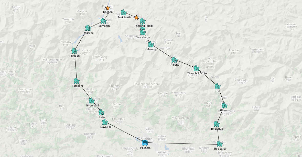 Click on the map for a Google map interactive version
Around Annapurna Trek in detail
Day 1 Besisahar to Bhulbhule (trekking time 2 hours)
The first day involves little walking as most trekkers have either arrived from Kathmandu (6 hour drive) or Pokhara (5 hour drive). On arrival in Besisahar, it’s a straightforward couple of hours walk along the dirt road to Bhulbhule.
Accommodation in Bhulbhule
Lodges/teahouses
There are at least six teahouses in Bhulbhule. The Hotel Arjun is located on the river and has a welcoming garden plus clean and comfortable rooms.
Camping
There is a pleasant (and spacious) campsite just below the Hotel Arjun on the banks of the Mansandid River. This is the only campsite in the village.
Day 2 Bhulbhule to Ghermu (trekking time 5-6 hours)
Today is a fairly undemanding day of trekking. By walking on the east bank of the river, you are able to avoid the road for the first part of the trek. Most of the route is on the flat until it’s necessary to make a short climb up to Ngadi. From here it is flat again until a final ascent of approximately 300m to the village of Bahundanda. This is a good place to break for lunch and the walk beyond the village thereafter offers some fantastic views of the surrounding valley. Leaving Bahundanda behind, it’s a gradual descent for about an hour followed by a short but steep climb up to Ghermu.
Accommodation in Ghermu
Lodges/teahouses
There are a handful of teahouses in Ghermu, all of which are reasonably basic but OK. The best one is the Rainbow Restaurant and Guesthouse right at the far end of the village.
Camping
There is only one campsite in Ghermu which is located on the outskirts of the village, as you are leaving it. It’s near the river but in pretty poor shape and therefore not recommended.
Day 3 Ghermu to Tal (trekking time 5-6 hours)
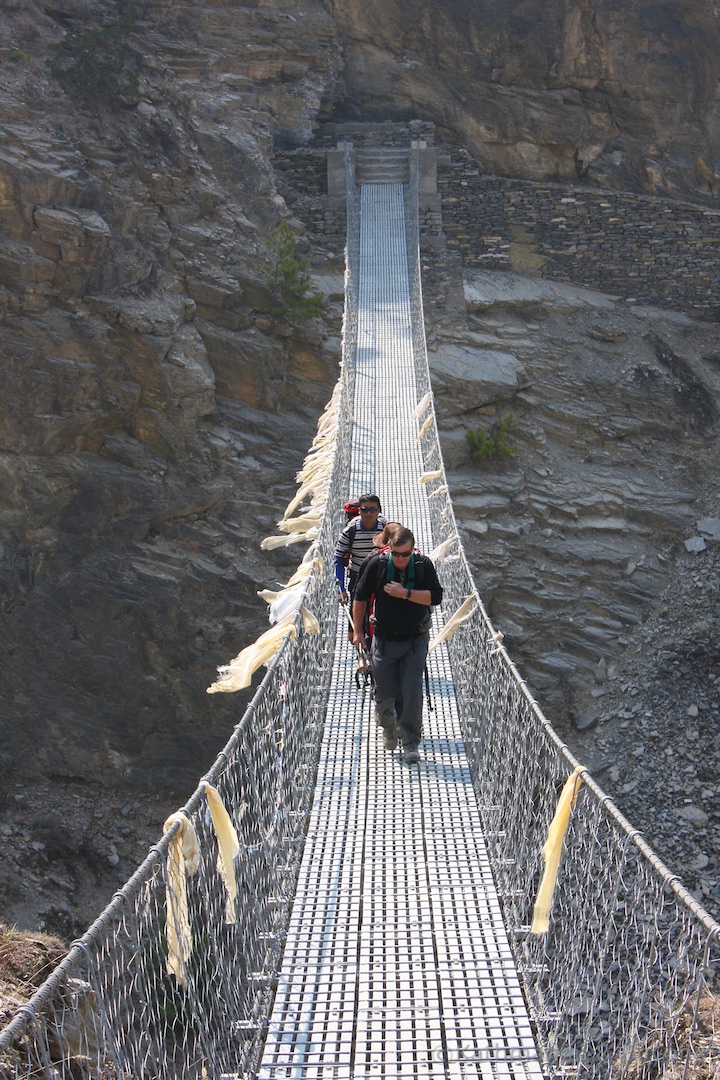
After leaving Ghermu, head immediately down to the river and cross the long suspension bridge to the other side. The exposed trail then ascends and it’s a steep 200m climb/scramble up to the top of the ridge, which is followed by relatively flat section as far as Jagat. This section takes about 1.5 hours to complete and is followed by an easy walk to Chamje, where it is possible to take an early lunch. After leaving Chamje, it’s a stiff 2-hour climb up to the entrance to Tal. If the weather is clear, there is a fantastic view of the lake and village before you.
Accommodation in Tal
Lodges/teahouses
Tal is an attractive village and there are several decent places to overnight. Both the Annapurna Hotel and the Lhasa Hotel have good, comfortable rooms.
Camping
The best spot is located in the grounds of the monastery. There is electricity, a clean toilet, area for cooking/eating, running water and plenty of space for tents. It is also close to the waterfall which makes for a pleasurable, late afternoon stroll.
Day 4 Tal to Thanchok (trekking time 7 hours)
After leaving Tal you follow the riverbed, climbing gradually and crossing back and forth across the river. From Tal, it takes about 2.5 to 3 hours to reach Dharapani from where it’s a short and gradual climb to Bagarchhap. This is a good place to break for lunch. After leaving Bagatchhap it is necessary to make a steep climb up of about 100m to Timang Besi. This is a tough climb but you will be rewarded with impressive views. You’ve got to continue going up after leaving Timang Besi but at least the climb is more gradual and after approximately 1.5 hours of slogging you will arrive at Thanchok.
Accommodation in Thanchok
Lodges/teahouses
Thanchok is a lovely village but accommodation choices are limited. The Himalayan Hotel is a reasonable option but if it’s full, or you prefer more choice, then push on for another 40 minutes to Koto (also known as Kyupar), where there is a better selection of teahouses (but no camping).
Camping
The best campsite is at the top of the ridge just before you enter the village. It is attached to a teahouse and therefore has the use of a toilet and dining hall. There is room for several tents at the campsite. It also has a great location with fine views of Bougha to the south-east and Lamjung to the south-west.
Day 5 Thanchok to Pisang (trekking time 6 hours)
Passing through the village, the trail continues on the flat as far as Koto, a 40 minute walk away. Alpine scenery awaits soon after leaving Koto and you should catch your first glimpse of the BIG mountains to your left to include Annapurna II. You will reach Chame, the district HQ, after about 45 minutes. Chame is a large village with plenty of shops, internet access, good teahouses and two campsites (one at the entrance to the village and one at the end close to the monastery).
 En route between Thanchok to Pisang
The scenery starts to change as you leave Chame, with the vegetation starting to become more barren. The views of the mountains and the river along this stretch are excellent. From Chame it is a gradual climb up (nothing too taxing) as far as Bhratang, which is a convent place to stop for lunch. Very soon after leaving Bhratang you get your first view of the impressive Paungda Danda rock-face. After crossing the river it is a long but gentle climb up to the small settlement of Dhukure Pokhari, from where it is a level walk through the Manang Valley to Pisang. Once again the views along this stretch are tremendous.
Accommodation in Pisang
Lodges/teahouses
Most of the teahouses are located in Lower Pisang and the choice is good. Reasonable options include Hill Top Super View, Eco Cottage, and the Tibetan Guesthouse. There are also a few teahouses in Upper Pisang, the more traditional part of the village, but the standard is not as high.
Camping
There are two good campsites in Lower Pisang, one at the entrance to the village and one at the exit. Both are spacious and have cooking facilities.
Optional rest day in Pisang
Pisang (especially the upper section) is a very interesting village with some outstanding mountain views and so a day off to take it all in is a good idea. From the village, there is the option to trek up to Pisang Peak Base Camp (4200m), a tough 3.5-hour climb that offers some incredible views of the surrounding mountains, including an uninterrupted view of Annapurna II, as well as a panoramic vista of the Manang Valley. The whole excursion takes in the region of five hours and with an early start (which is recommended in order to ensure the clearest views) it is possible to be back in Pisang in time for lunch. For the less energetic, there is the option of a one-hour climb up to the ruins of the old fort, which also offers superb mountain views. As a final suggestion, it is also worthwhile spending some time exploring atmospheric Upper Pisang.
Day 6 Pisang to Manang (trekking time 4 or 7 hours)
There are two options for the trek between Pisang and Manang. The normal route will take you through the valley via Hongde and Mungji and for the best part is on the flat. The slightly more strenuous (and certainly longer) alternative is via the villages of Ghyaru and Ngawal. Assuming the longer route, after leaving Upper Pisang stay on the flat for about 30 minutes until you pass a small green lake. Then climb via a series of switchbacks to Ghyaru, a picturesque settlement where it is possible to explore the gompa and take in the fantastic views. From here it is an easy trail to the Ngawal, another traditional village and the ideal spot to break for lunch. As you leave Ngawal you begin to get excellent views of Annapurna II and III as well as other mighty peaks. You rejoin the original (regular) trail at Mungji, from where it’s a 45 minute trek on the flat to Manang itself. This is a fantastic alternative to the regular route and highly recommended.
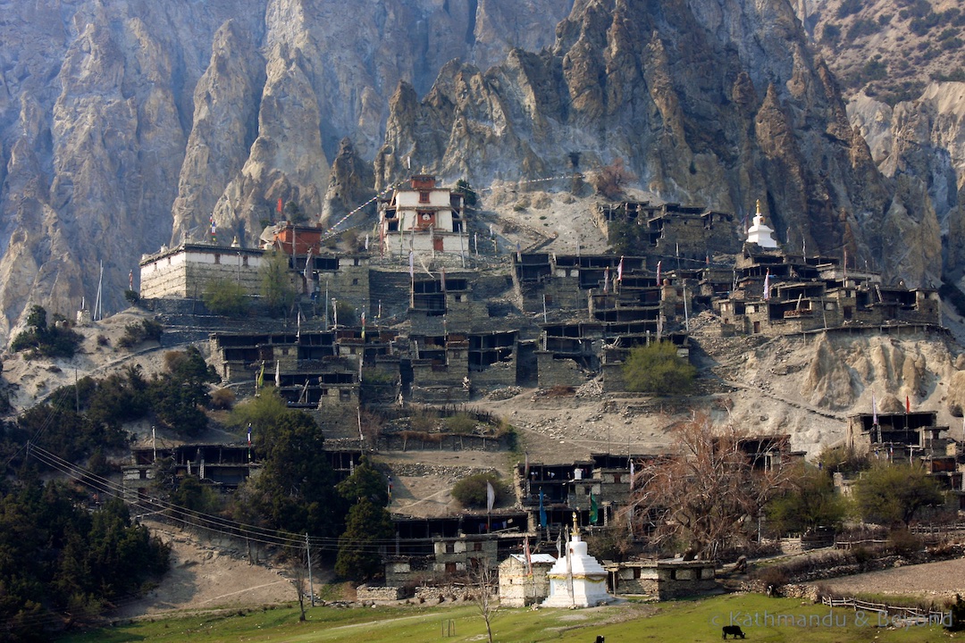
En route between Pisang to Manang with the village of Ngawal (right)
Accommodation in Manang
Lodges/teahouses
There are plenty of options in Manang. The Yak Lodge is an excellent choice – many of the rooms have private bathrooms and there is plenty of hot water. Another good choice is the Hotel Himalayan Singhi.
Camping
There is one very small campsite opposite the Yak Lodge in Manang but a better suggestion, if you are camping, would be to overnight in nearby Bragha (Bryaga), where there is a pleasant campground situated in the meadow below the gompa. Bragha is situated a short distance before Manang if coming from Pisang.
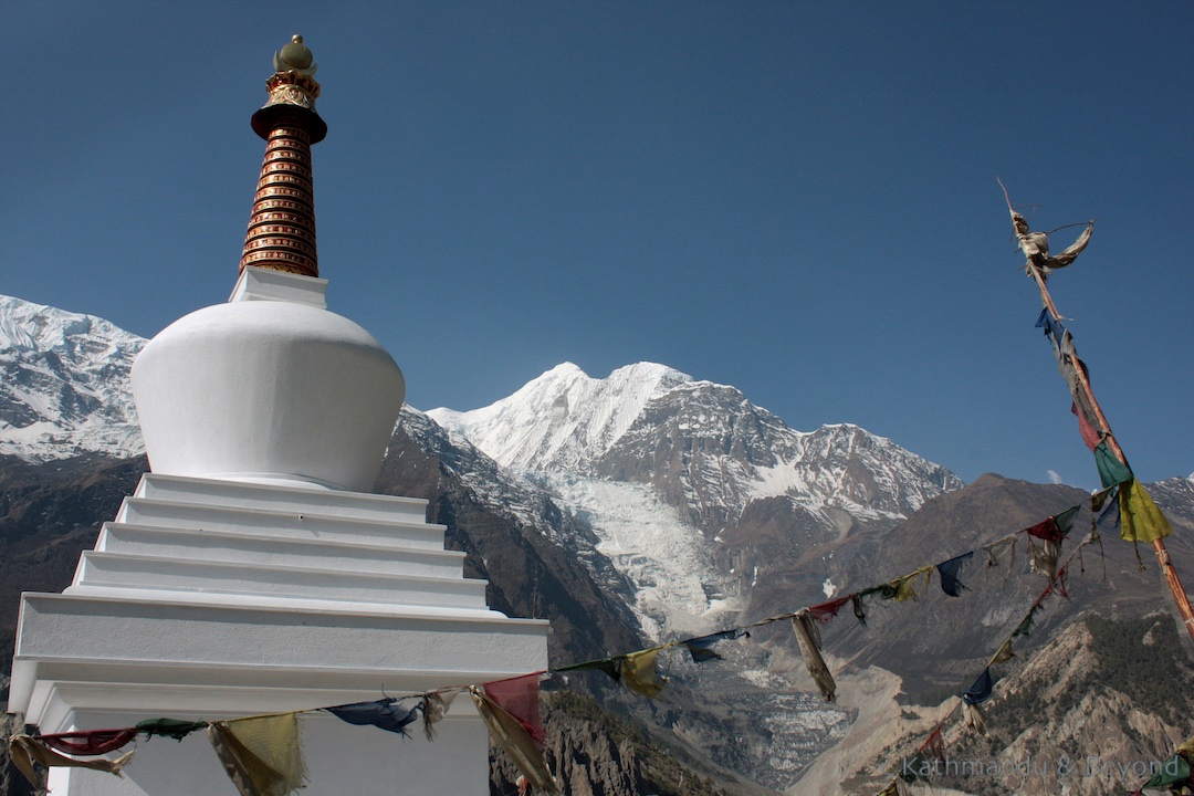
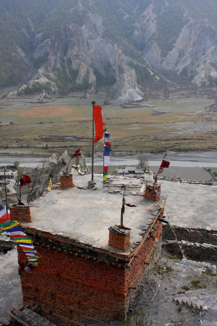
 Manang region
Day 7 Rest day in Manang
It is essential to include this rest day in Manang in order to aid acclimatisation. Manang itself is a fascinating place and the backdrop of arid rocks and cliffs plus huge mountain peaks make it a very agreeable place to spend an additional night (or even two). There are plenty of day excursions, including a one-hour climb up to the ridge north of the village for superb mountain views. Also nearby is Bhojo Gompa, the most active monastery in the region. If strenuous activity doesn’t appeal then grab a coffee or a sea-buckthorn juice (a delicious berry-based drink that is packed with vitamins), relax, catch a few rays and soak up the atmosphere – Manang is perfect for such an activity.
Manang (left) and Bryaga (right)
Day 8 Manang to Yak Kharka/Letdar (trekking time 3-4 hours)
After leaving Manang the path climbs up to Tengi before entering the Marsyangdi Valley. The views are sublime as you steadily climb to the village of Gunsang (1.5 hours). Departing Gunsang, keep climbing (again steadily) until you reach Yak Kharka where there are a handful of reasonable teahouses should you decide to spend the night. From here it is another hour to Letdar, the penultimate settlement before reaching the pass. Although this is a short day, do not be tempted to continue beyond Letdar as acclimatisation on this section of the trek is absolutely essential.
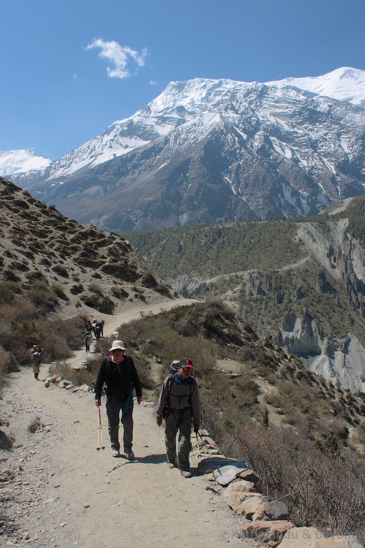
En route between Manang and Letdar (left) and en route between Letdar to Thorung Phedi/High Pass (right)
Accommodation in Letdar
Lodges/teahouses
There are three teahouses in Letdar, all basic and not particularly inviting. As mentioned above, it is possible to spend the night in Yak Kharka, where the choice of teahouse is superior. You would lose an hour of trekking time by not pushing onto Letdar but this is not a big deal as the trek to Thorung Phedi/High Camp on the following day is also a short one. If staying in Letdar, Jimmy’s Hotel is OK. In Yak Kharta, Gangapurna Lodge is a good choice.
Camping
There are two campsites in Letdar – one is located at Jimmy’s Hotel and the other at Pema Hotel. Both are exposed to the elements, but acceptable.
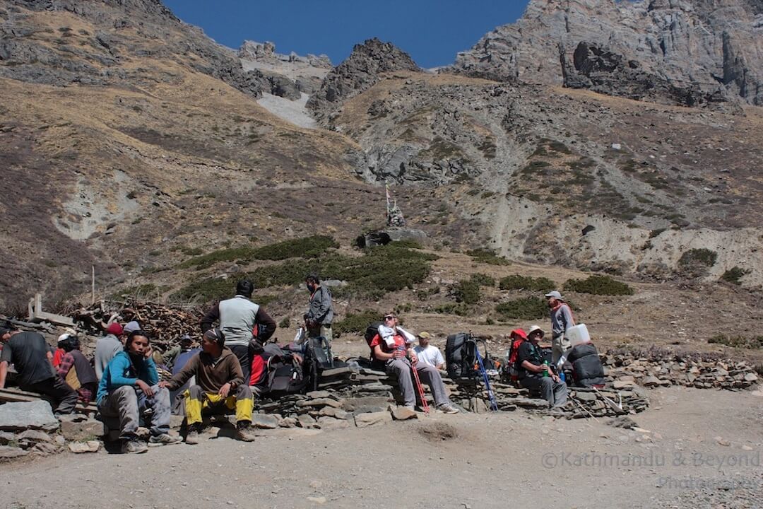
Day 9 Letdar to Thorong Phedi/Thorong High Camp (trekking time 4 or 6 hours)
As you leave Letdar you climb gradually for about 40 minutes and then eventually climb up about 100m to Deirali where you get excellent views back down the valley and up towards the pass. From here it is another 40 minutes or so to Thorong Phedi (4540m), which is one of two choices for the overnight stop before tackling the pass the following day. The alternative is to keep going up another 260m to the High Camp (4800m) and sleeping there.
 En route between Letdar and Thorong Phedi/High Pass
There are advantages and disadvantages with both options. Staying lower means you have a better opportunity to acclimatise before tackling the pass. Furthermore, it is not as cold at Thorong Phedi as it is at High Camp and will you stand a better chance of getting a half-decent night’s sleep. On the downside, Thorong Phedi can get extremely crowded with trekkers, especially in high season. Staying at High Camp, on the other hand, will cut the following day’s trek by at least 1.5 hours but, on the flip side, you will be spending the night at a higher altitude and therefore have more risk of illness. High Camp is a desolate and very uninviting place and the climb from Thorong Phedi to High Camp is very tough, regardless of when you decide to undertake it.
Accommodation in Thorong Phedi/High Camp
Lodges/teahouses
There are two teahouses (possibly a third by now) at Thorong Phedi that somehow manage to accommodate and feed up to 200 trekkers. At High Camp, there is just the one teahouse, which is also quite big. All the teahouses in both locations are reasonably basic but well-run and not bad given their remote location.
Camping
Both Thorong Phedi and High Camp have campsites but it can get extremely cold at night in both places so I wouldn’t recommend using them unless desperate.
Day 10 Thorong Pedi/Thorong High Camp to Muktinath (trekking time 6 or 8 hours)
This is the big day! Regardless of whether you spend the night in Thorong Phedi or High Camp, once you hit the trail you have little choice but to make it all the way to Muktinath or return the way you came, as there is nowhere else to stay en route. If you have slept and survived the night at High Pass then you have the advantage of an hour or so head start. If you slept in Thorong Phedi then your first challenge is to tackle the steep switchbacks and moraine that lead up to High Camp.
It’s a good idea to make an early start, regardless of where you slept the night before, for a couple of reasons. Firstly, it’s a long day and until you get going, you don’t know what sort of pace you are going to be able to manage. Some trekkers start walking around 4am but this isn’t really necessary. A departure at daybreak (6am) is perfectly OK. The other reason to make an early start is because by 10am the wind can really start to pick up and it is best to avoid this as much as possible.
The climb up to the Thorong La starts immediately after leaving High Camp and it is a full-on assault until you reach the pass some 2.5 to 3 hours later. Elation at reaching the top of the pass is short-lived as soon as you notice the steep descent down on the other side. Although not as strenuous as the climb up, the way down is very tricky indeed and requires a lot of concentration. It can be very slippery underfoot if there is ice or snow on the terrain. What’s more, the descent can be extremely painful on the knees.
Overall, crossing the Thorong La doesn’t require any technical skill but it will drain your deepest energy reserves and, as mentioned above, requires a certain degree of concentration. The trail is well defined but it can be harder to identify if the weather is bad and visibility poor – look for pole markers if this is the case and follow them.
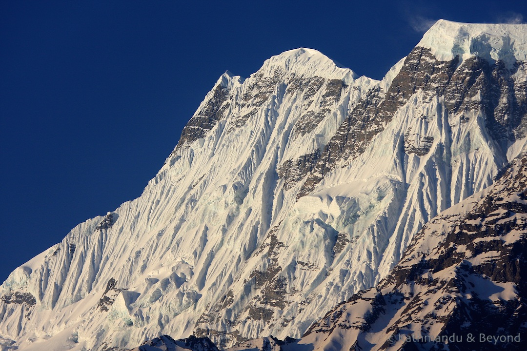
In fact, the weather is one of the hardest challenges in crossing the Thorong La. If you are lucky, the sun will be shining, the sky will be blue and you will get a view from the top of the pass that will remain in your memory for a lifetime. If on the other hand, the weather is bad you may have to tackle anything from sleet and snow to a full-on blizzard. The pass tends to be snowbound from mid-December to late February but you can expect snow at any time of the year.
 The view we were hoping for on the Thorong La
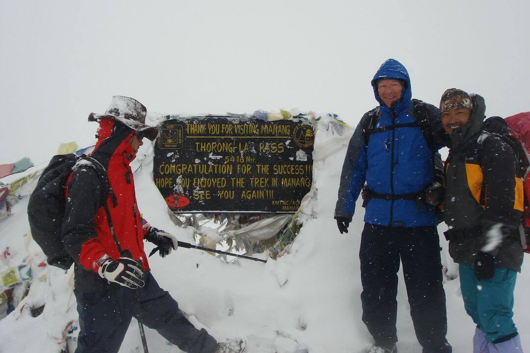 The view we had at the top of the Thorong La!
Eventually, you will reach Muktinath which, after a couple of days of basic accommodation, will seem well developed in comparison. Furthermore, Muktinath is an interesting place which attracts many pilgrims to its temple and religious shrines but you will probably want to save the exploring until the following day unless you are off-spring of Superman or Wonder Woman!
It is possible to pick up transport in Muktinath that will take you Tatopani and ultimately to Pokhara – a tempting proposition, considering what you have just been through!
Accommodation in Muktinath
Lodges/teahouses
There are a couple of reasonable places to stay in Muktinath, including the North Pole Lodge and the Muktinath Hotel.
Camping
There is a small and not very pleasant campsite called the Dhaulagiri campsite close to the Muktinath Hotel. The Muktinath Hotel also has an uninspiring campsite plus there is a third one in the centre of the village.
Day 11 Muktinath to Marpha (5 -6 hours)
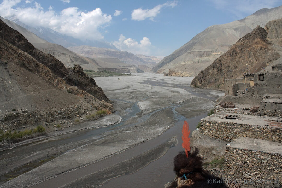
It is worth spending part of the morning in Muktinath in order to take in the outstanding mountain views and visit the temple complex. Thereafter it is a straightforward walk (mostly gradual downhill) via the village of Jharkot to Jomsom. There are stunning views for much of the way. It takes about 4 hours to reach Jomsom, which is a good place to take lunch. The final stretch to Marpha should provide good views of the Nilgiri range but is, in fact, a pretty unattractive walk partly on the river bed and partly on the road. Marpha itself, on the other hand, is a delightful Thakali village with lots of traditional stonework and a large monastery. The village is well worth exploring for an hour or so.
Accommodation in Marpha
Lodges/tea houses
There Is plenty of accommodation in Marpha but the best two teahouses are slightly outside the village; the Hotel Transhimalaya is on the Jomsom side of the village and the Rita Guesthouse is on the southern side. Both are good.
Camping
Both the above properties have campsites and of the two, the one at the Hotel Transhimalaya is the nicest.
Optional side trip to Kagbeni
Kagbeni is the perfect medieval-style village and a beguiling detour between Muktinath and Marpha. It is a fantastic and easy 3-hour walk from Muktinath to Kagbeni. It takes 30 minutes to reach Jargot, the next village along from Muktinath, from where you get a superb view back towards Muktinath and the Thorong La. From here, follow the road for the best part all the way to Kagbeni. Although you climb down nearly 1000m to reach Kagbeni, it is a gentle descent and not too taxing.
The rest of the day can be spent exploring Kagbeni. It is worth heading out to the police check-post at the northern end of the village for superb views of Upper Mustang. Also, the Kagchode Thubten Shampheling gompa, which has not long been open to visitors, is an interesting place to visit. The following day, it is a straightforward walk via Jomson to Marpha which will take approximately 5 hours to complete.
 Looking towards Upper Mustang from the police checkpoint at Kagbeni
Accommodation in Kagbeni
Lodges/teahouses
There are at least four decent teahouses in Kagbeni to choose from. The Mustang Gateway Hotel is excellent – rooms are spacious, clean and have private bathrooms. Other good places to stay include the Asian Trekkers Home, which is located close to the entrance to the village, the Shangri La Hotel, and the New Annapurna Lodge.
Camping
There are three campsites within the village. The best is close to (almost opposite) the Mustang Gateway Hotel.
Day 12 Marpha to Kalopani (trekking time 6 hours)
This is an undemanding but long walk with no real challenges along the way. Unfortunately, most of the journey is along the road and so you do encounter some traffic. It’s worth checking with the ACAP office in Jomsom if there are any alternative routes that will take you away from the road.
Kalopani is a pleasant village and offers some breathtaking views of the Annapurna Massif to include Dhaulagiri (the White Mountain) and Tukuche Peak. For the best view, walk for 30 minutes up to the 360-degree panoramic viewpoint at Dhulu Danda.
 Mountain view from Kalopani
Some trekkers continue onto nearby Lete but the accommodation is superior in Kalopani.
Accommodation in Kalopani
Lodges/teahouses
There are three good teahouses in Kalopani, the Kalopani Guesthouse, the Alpine Guesthouse and the See You Guesthouse. Each one offers rooms with private bathrooms and a welcoming dining room/communal area.
 See You Guesthouse, Kalopani
Camping
There is no official campsite in Kalopani but it is possible to pitch camp in the woods just behind the Alpine Guesthouse, which makes for a very pleasant stay.
Day 13 Kalopani to Tatopani (trekking time 6-7 hours)
This is yet another long but straightforward day of trekking. Throughout the course of the day you go down from 2530m to 1190m but you hardly notice it as the descent is very gradual. After passing Ghasa you will observe a considerable increase in traffic and have to keep breaking your stride to let the trucks, buses and micro-vans pass by if you continue on the road. The alternative is to cross the river using the suspension bridge at Ghasa and walk down the eastern side of the valley. Furthermore, the closer you get to Tatopani the warmer and more tropical it becomes. Lunch can be taken at Rukse Chhahara, where there is a small waterfall. Tatopani translates as hot water in Nepali and a well-earned soak in the village’s hot springs is a great way to while away an hour or so. Don’t forget to pack your swimsuit!
Accommodation in Tatopani
Lodges/teahouses
Once more, there are two decent teahouses in Tatopani; the Dhaulagari Lodge and the Hotel Himalaya. In my opinion, the best one is Dhaulagari Lodge. The rooms are pretty basic (although most have private bathrooms) but the property is set in attractive gardens and is close to the hot springs. Furthermore, the food is excellent and the menu varied.
Camping
There is a pleasant campground towards the northern end of the village, close to the Namaste Lodge. The disadvantage is that it is located close to the bus park and can get a bit noisy.
Day 14 Tatopani to Ghorepani (trekking time 6-7 hours)
Needed like a hole in the head at this stage in the trek, today’s long hike requires you to undertake the biggest ascent on the entire circuit – 1190m at Tatopani up to 2750m at Ghorepani. The temptation to take some form of transport directly to Pokhara, which is 80km away, is overwhelming but if you a) want to say you have completed the Annapurna Circuit in its entirety, b) want to see the view from Poon Hill and c) want to continue to Annapurna Base Camp then you have little choice but to complete this section. There are a couple of steep parts on the trail, namely up to Khopra Ridge and the steep ascent to Durbin Danda. You will pass through the settlements of Paudwar, Ghar Khola, Ghara and Shikha. When you reach Chitre there are several trails to choose from – take the steepest looking one, this will eventually lead to outskirts of Ghorepani after about an hour or so.
Accommodation in Ghorepani
Lodges/teahouses
Ghorepani is a reasonably-sized village and there are several teahouses to choose from. Personally, I didn’t think anywhere was that great but the Sunny Guesthouse was acceptable and the cottages (rather than the rooms) should be your first choice if you want an attached bathroom and superb views of the mountains. The welcoming dining room was cosy and got very busy with trekkers. Snowlands, at the top of the town, is also an acceptable choice.
Camping
Ghorepani has probably the worst choice of camping sites on the whole trek, all being in built-up areas and not particularly spacious. The area at the Mountain View is the best of a bad bunch.
Day 15 Ghorepani to Tikhedhunga/Hille (trekking time 5 hours)
This is a fairly tricky day that also ends up being a long one if you include the early morning side trip to Poon Hill for sunrise (which you should definitely do, by the way). The trek itself is tricky because the route is predominantly downhill all the way and in sections, when close to water, it becomes very slippery underfoot making progress fairly slow. Immediately after leaving Ulleri the trail comprises of very steep steps down for about 40 minutes and this can be painful on the knees, especially after several days of trekking. On the plus side, it gets much warmer as you head down; Ghorepani is at 2750m and Tikhedhunga 1540m and you can feel the difference.
Accommodation in Tikhedhunga/Hille
Lodges/teahouses
Tikhedhunga and Hille more or less merge into one and both are attractive looking villages (the outlook being over the river and terraces as opposed to the mountains) that are well equipped with good teahouses and campsites. The best teahouse is Laxmi Lodge in Tikhedhunga (not to be confused with the Laxmi Lodge in Hille or the one in Birethanti!). There is a good restaurant adjoining and rooms are clean with private bathrooms and hot running water.
Camping
There are two very nice camping spots, both located in Hille and close to each other (near the Nisha Teahouse). Both have views of the river and the terraced fields
Day 16 Tikhedhunga/Hille to Naya Pul (and drive to Pokhara) (trekking time 3-4 hours)
This is a pretty easy day and with a reasonably early start (say 8am) it is possible to get back to Pokhara for a late lunch although I think it is nicer to have an early lunch in Birethanti to ensure a healthy appetite for a nice slap-up feast of a dinner in Pokhara that evening!
Today’s walk is mostly flat all the way and again, there is very attractive (non-mountain) scenery along the route. The trail from Birethanti to Naya Pul involves a little bit of up but nothing too demanding. From Naya Pul, the end of the trek, it is then 1 to 1.5 hours’ drive back to Pokhara (depending on whether you are travelling by car or local bus).
Alternative ending for this trek
For the ultimate Annapurna experience, head east at Ghorepani via Ghandruk, Landruk and Dhampus (part of the Annapurna Foothills trek) as far as Chhomrong and from there, pick up the trail to Annapurna Base Camp. This would make for a wonderful trek. Allow another week to ten days to complete this section.
Opinion on the Around Annapurna trek
This is a tricky one to answer. I really enjoyed the variety that the trek had to offer; from Pisang on the eastern side of the route as far as Kalopani on the western side, the views are outstanding plus the ethnic diversity that you encounter on the trek (Manangis, Hindu pilgrims, Tibetan traders, etc.) is second to none. You also have the challenge of crossing the Thorong La, which for many trekkers, myself included, is an immensely satisfying achievement. But the downside is the development of the road that I talk about in more detail in the opening paragraphs. I cannot help but think that, eventually, the road will kill this trek off. Few trekkers complete the entire circuit these days, the temptation to take transport on certain portions of the trek are too tempting. On the plus side, at least ACAP are developing alternative routes that lead trekkers away from main roads and this is an encouraging sign for the longevity of what has to be one of Nepal’s most satisfying treks.
Disclaimer. This trek was undertaken a few years back and hence information about the splendour or otherwise of teahouses and camping sites may be slightly out of date. The Annapurna region suffered only minor damage during the devastating earthquake of April 2015 and the trekking routes were largely unaffected. I have checked with travel industry colleagues in Nepal and incorporated their updates but if you come across new information please feel free to update me. All such contributions will be duly acknowledged. Mark
You might also like:
An Introduction to Trekking in Nepal
Clothing and Equipment List for Trekking in Nepal