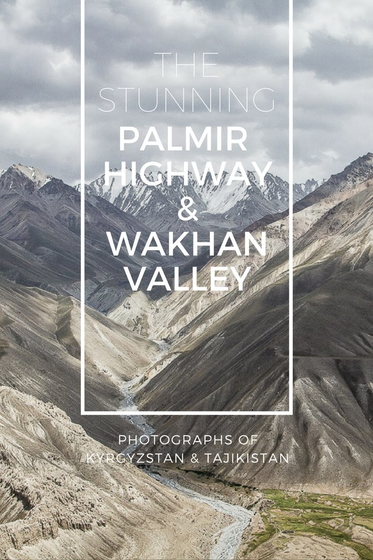
A photographic journal of our journey from Osh in Kyrgyzstan to Murgab in Tajikistan
This summer we took a road trip that will go down as one of the most visually enthralling adventures we have experienced: traversing a stretch of the renowned Pamir Highway before dropping down into the Wakhan Valley and following the river which forms a natural border between Tajikistan and Afghanistan.
Widely considered to be the second-highest highway in the world (after the Karakoram Highway which links China and Pakistan), the Pamir Highway begins (or ends depending on your direction of travel) in Osh in southern Kyrgyzstan and drops down into Tajikistan, spanning almost the width of the country before heading further south briefly into Uzbekistan before officially ending in the Afghan town of Mazarin Sharif. Forming one route of the historical Silk Road, the highway also goes by the less romantic name, the M41.
For those planning a trip to Kyrgyzstan and Tajikistan, we have written in much more detail here, but, because pictures speak louder than words, here is a visual record of our daily journey along the Pamir Highway and through the Wakhan Valley.
Day 1 – Osh to Tulpar-Kul near Sary Mogol (Kyrgyzstan)
Leaving Osh, it’s not long before the city melts away and gives way to Kyrgyzstan’s signature rolling hills and plunging valleys …
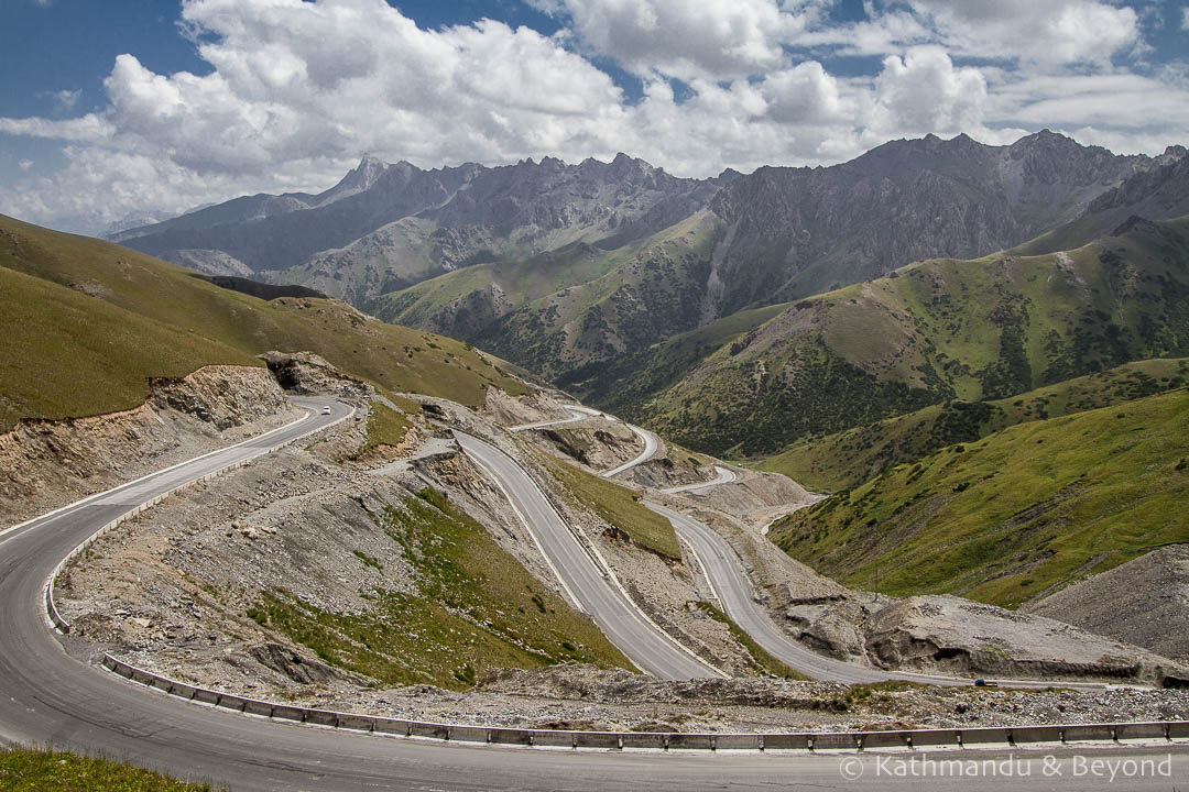 Osh to Sary Tash, Kyrgyzstan
 Osh to Sary Tash, Kyrgyzstan
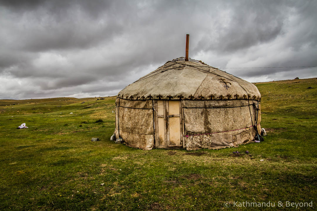
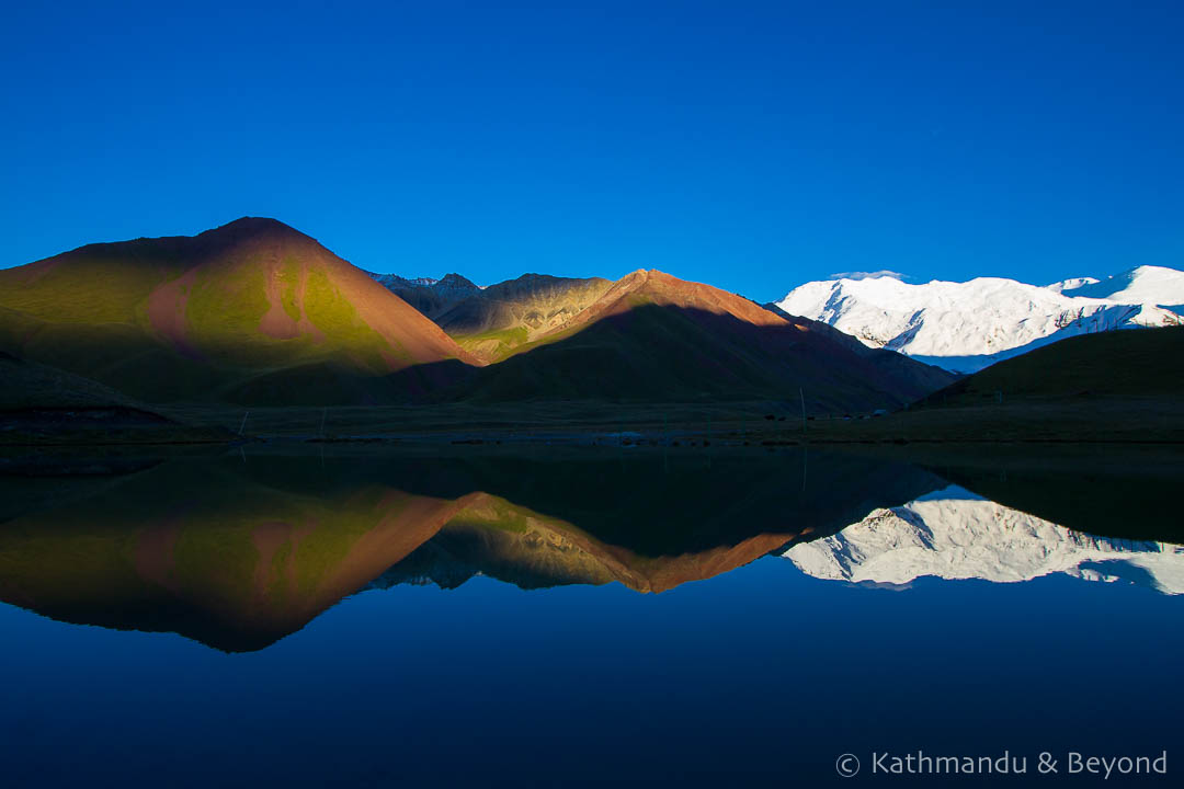
Our first night was spent on the shores of Lake Tulpar-Kul. It’s usually a peaceful spot, but our stay coincided with the traditional annual horse games providing us with a fantastic opportunity to spend the night in a yurt learn more about nomadic Kyrgyz culture.
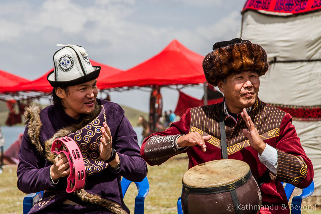 Lake Tulpar-Kul, Kyrgyzstan
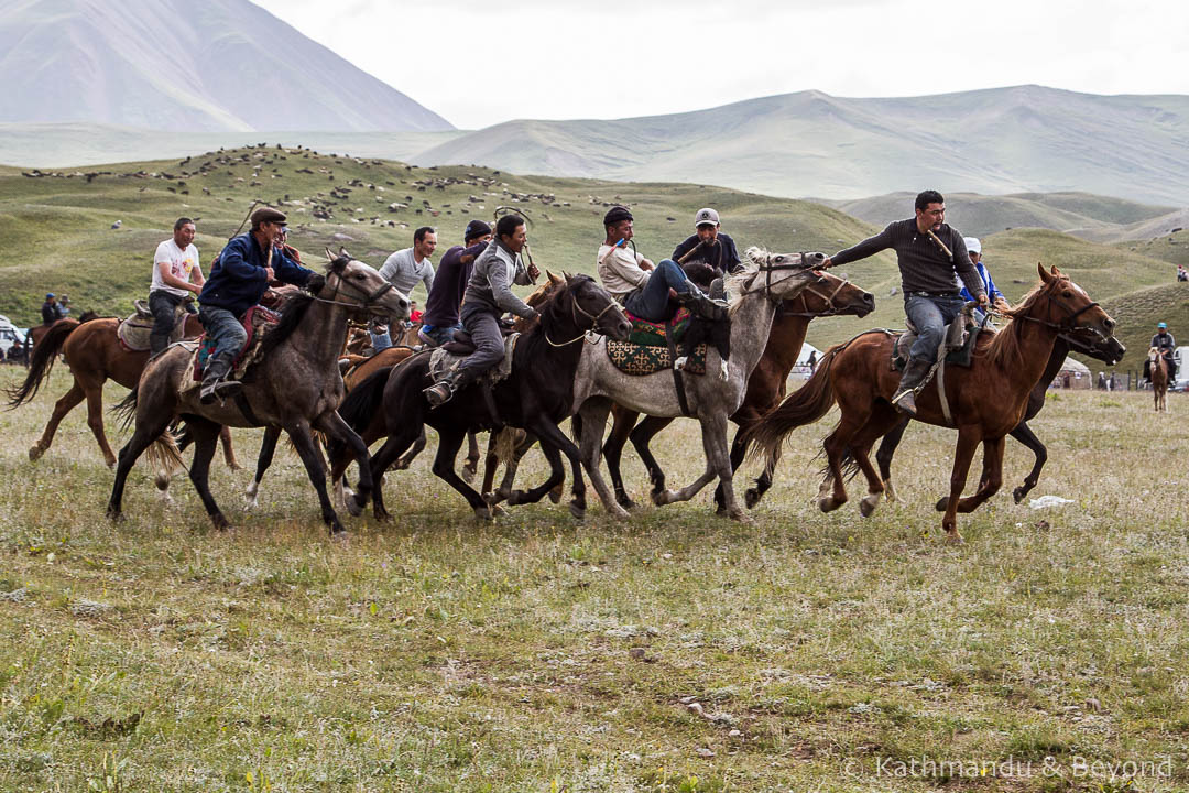 Lake Tulpar-Kul, Kyrgyzstan
 Lake Tulpar-Kul, Kyrgyzstan
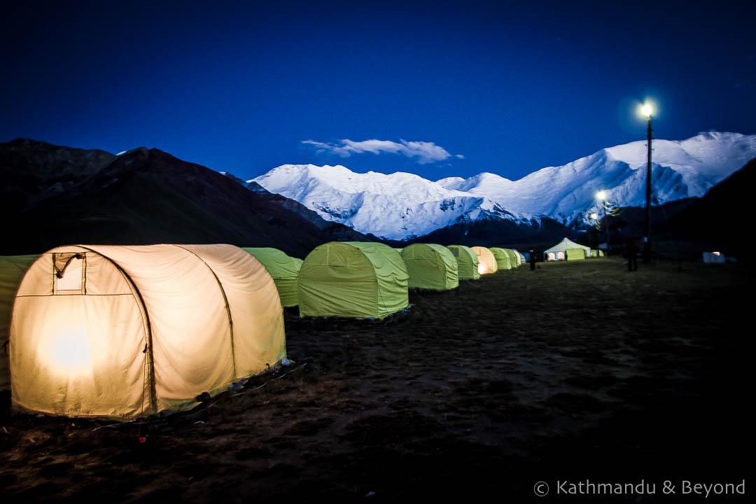
Day 2 – Tulpar Kul to Peak Lenin Base Camp, Achik Tash (Kyrgyzstan)
Geographically we had only a short distance to cover and had it not been pouring with rain, we might have hiked the 2 to 3 hours from Tulpar Kul to Peak Lenin Base Camp. Instead, the drive took a similar amount of time, traversing roads with no markings across the jailoo – pastures for Kyrgyzstan’s nomadic people.
 Lake Tulpar-Kul, Kyrgyzstan
 Sary Mogol to Peak Lenin Base Camp, Kyrgyzstan
 Sary Mogol to Peak Lenin Base Camp, Kyrgyzstan
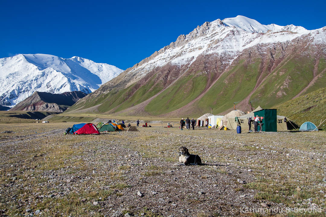
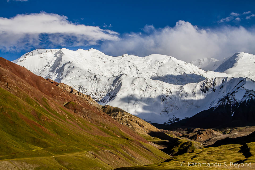
We arrived at Peak Lenin Base Camp in thick, freezing fog, pouring rain and a bitter wind. Miraculously, during lunch, the weather started to clear and by late afternoon we were rewarded with the most spectacular views of Peak Lenin and the surrounding mountains.
 Peak Lenin Base Camp, Kyrgyzstan
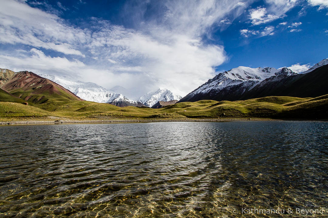 Peak Lenin Base Camp, Kyrgyzstan
 Peak Lenin Base Camp, Kyrgyzstan
Day 3 – Peak Lenin Base Camp, Sary Mogol to Sary Tash to Karakul (Kyrgyzstan to Tajikistan)
We awoke to an equally stunning day …
 Peak Lenin Base Camp, Kyrgyzstan
 Peak Lenin Base Camp, Kyrgyzstan
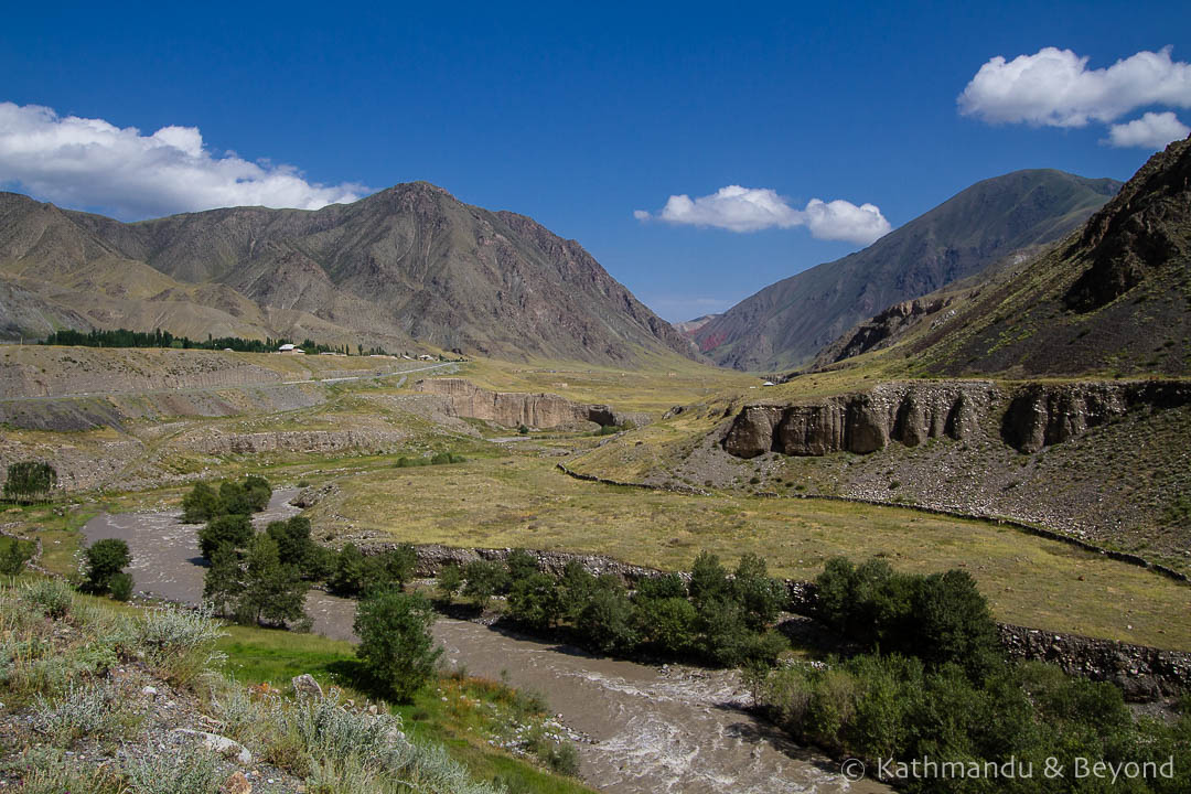
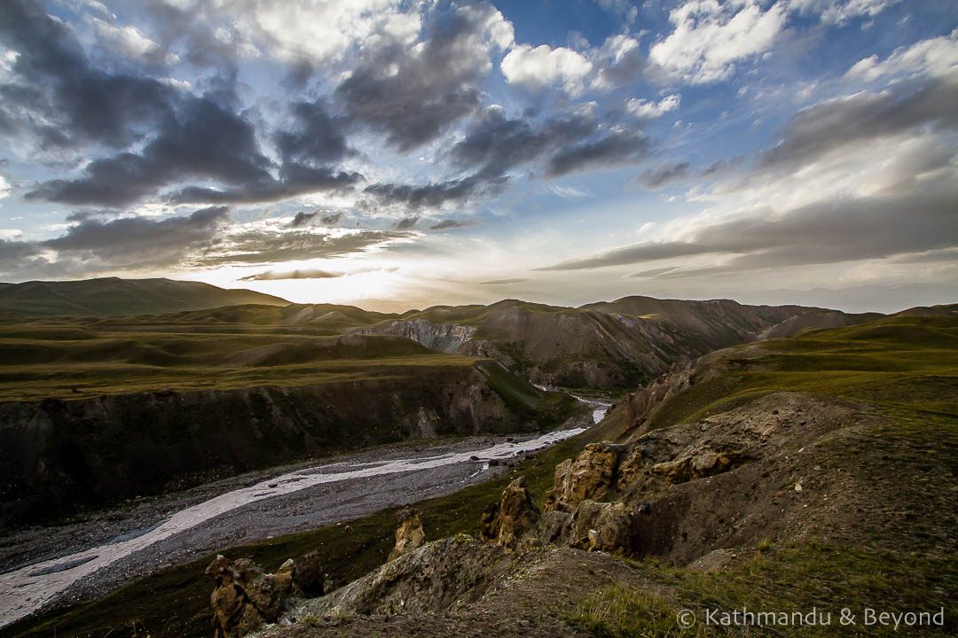
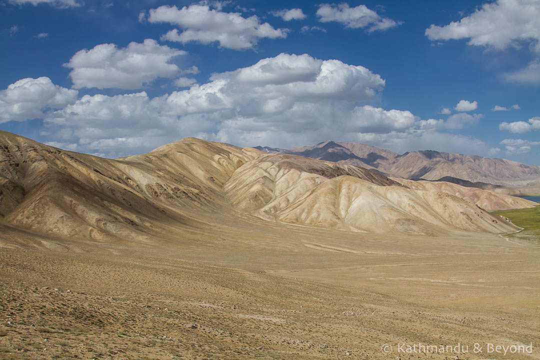
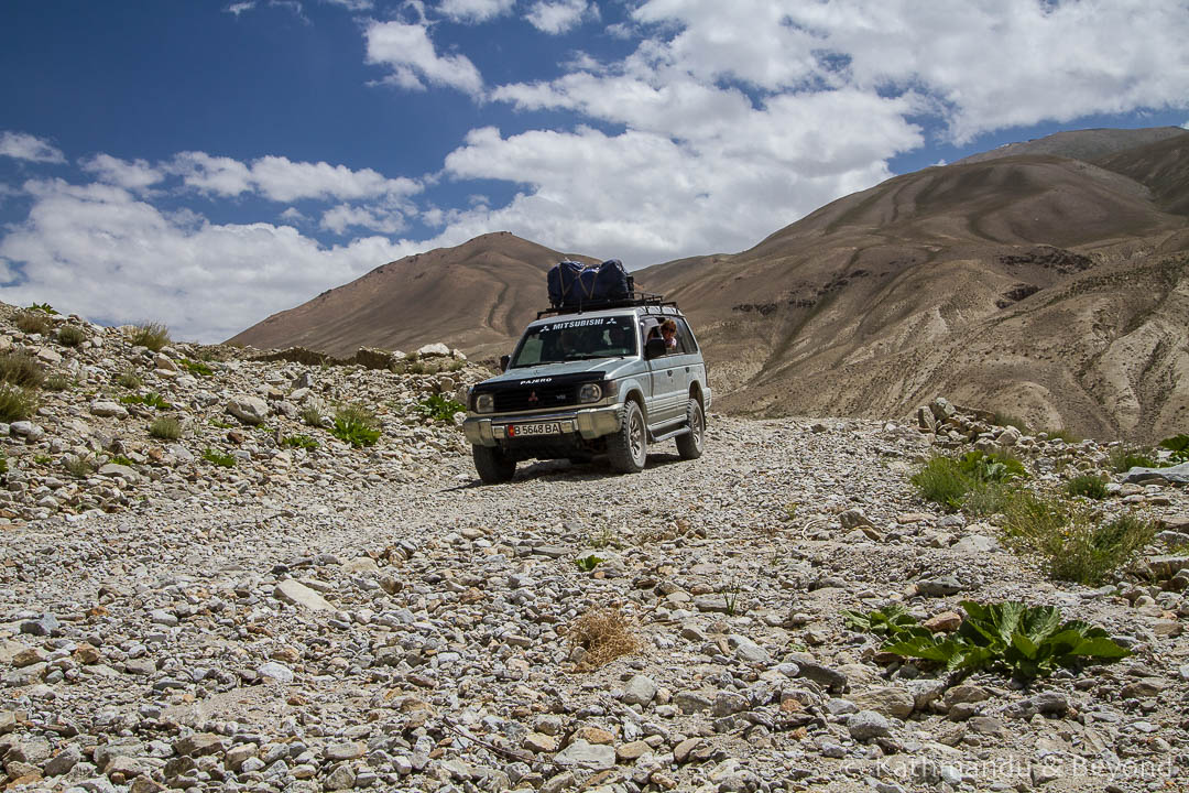
After leaving Base Camp we returned the same way back to Sary Mogol, on to Sary Tash and towards the border with Tajikistan. As the elevation started to increase, the scenery became noticeably more arid and the green started to be broken up by brown patches of bare earth and rock.
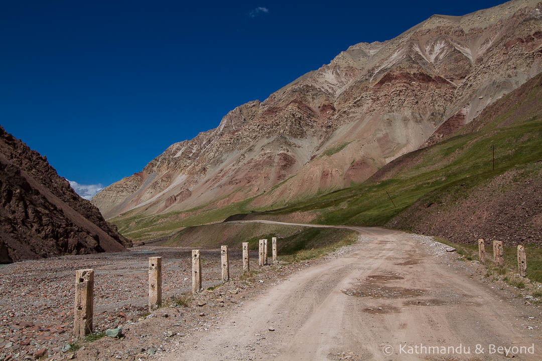 Tajikistan border to Karakul on the Pamir Highway, Tajikistan
 Tajikistan border to Karakul on the Pamir Highway, Tajikistan
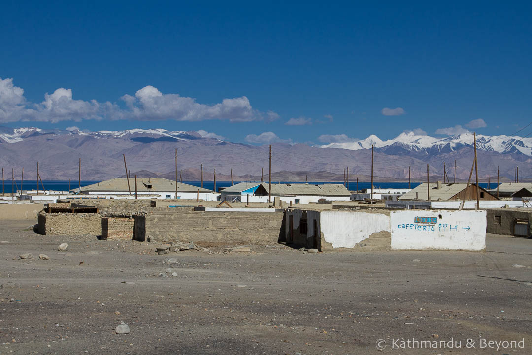
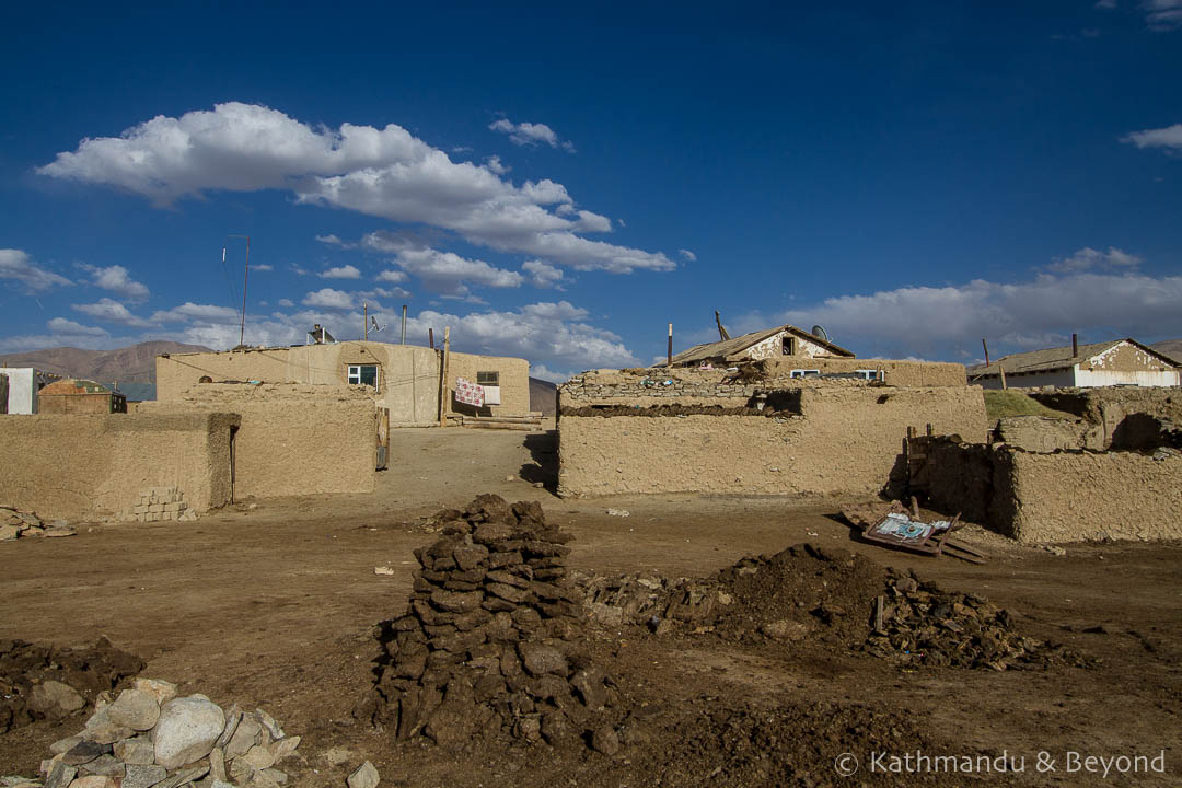
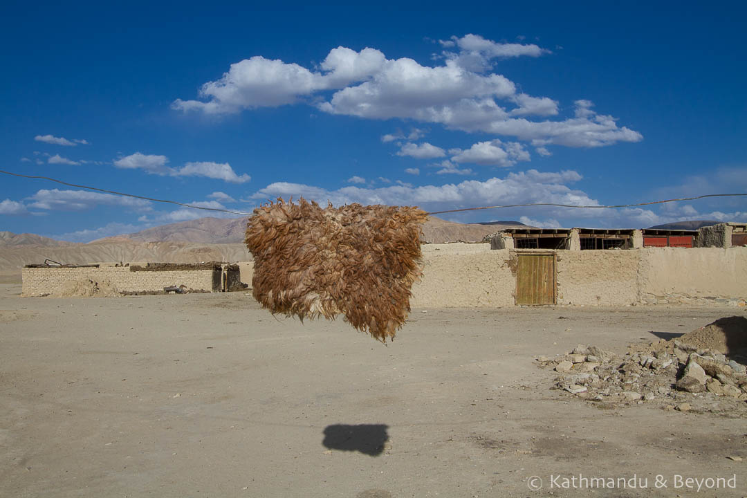
Our first night in Tajikistan was spent in the town of Karakul, on the shores of the lake of the same name. A settlement rather than a town, Karakul consists of several low-rise white-washed houses and reminded us of remote north Africa. Despite being situated at 3,914 metres above sea level, Kara Kul is a salt lake and is part of the UNESCO-listed Tajik National Park.
 Kara-Kul Lake, Tajikistan
 Karakul Village, Tajikistan
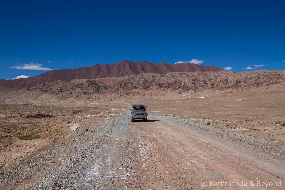
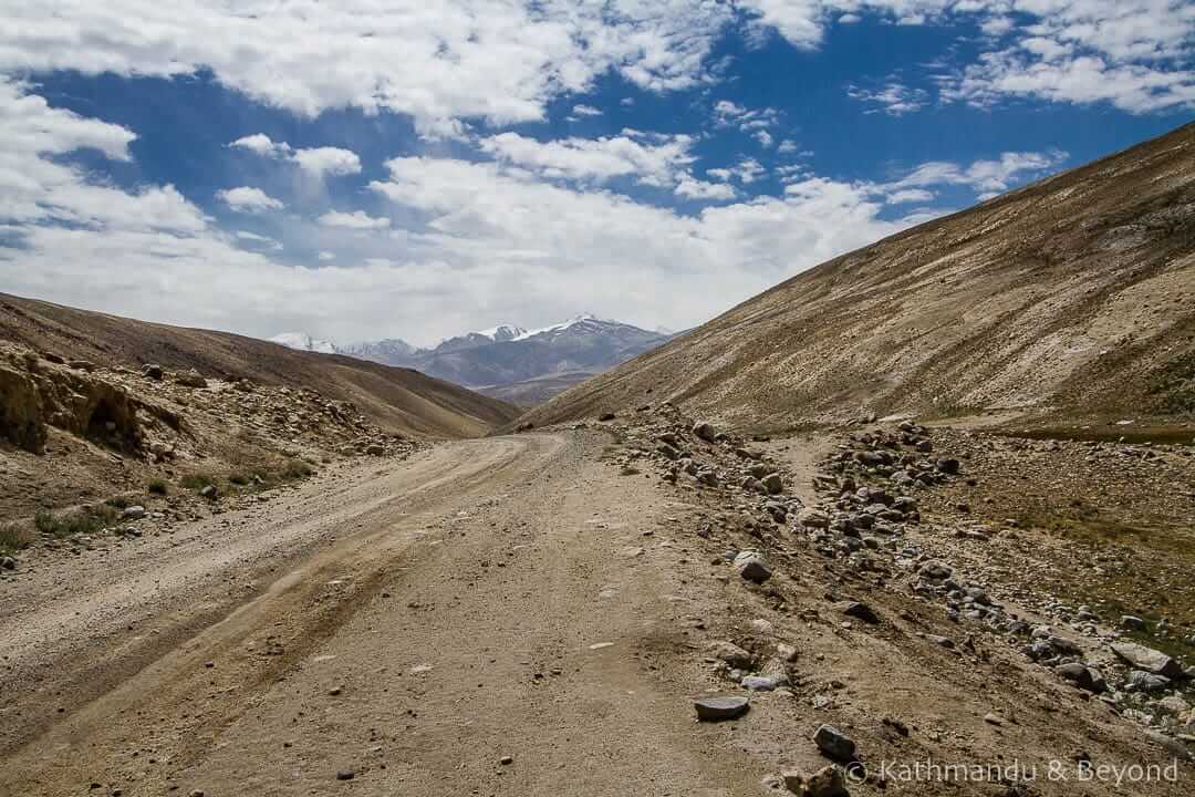
Day 4 – Karakul to Murgab and the Pshart Valley (Tajikistan)
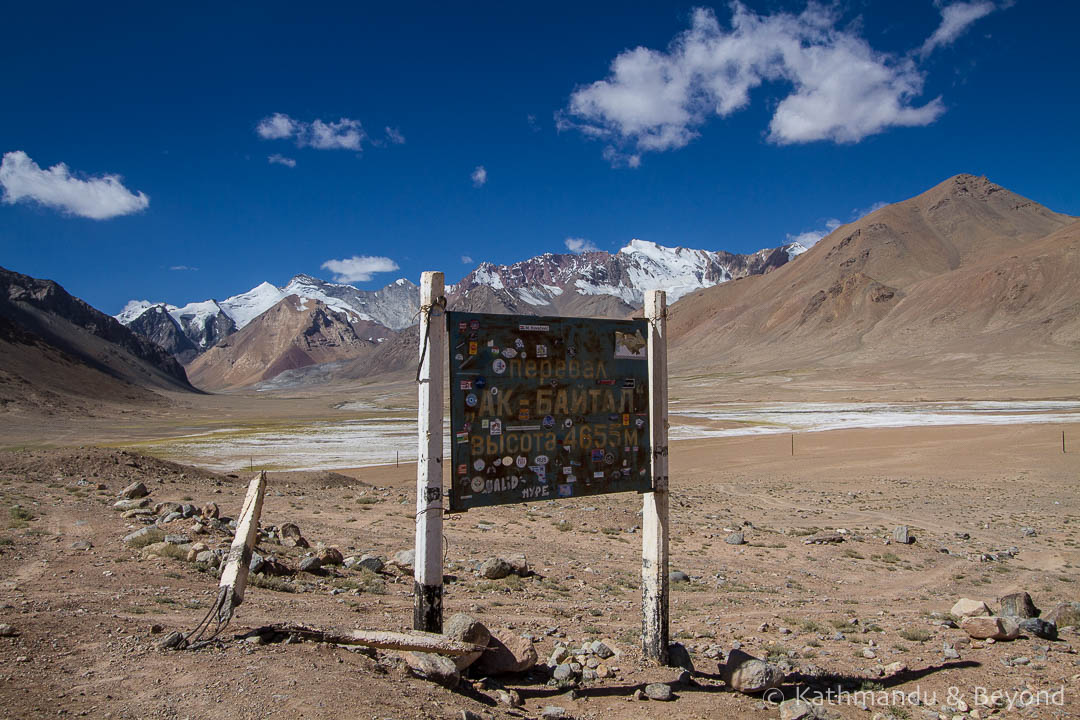
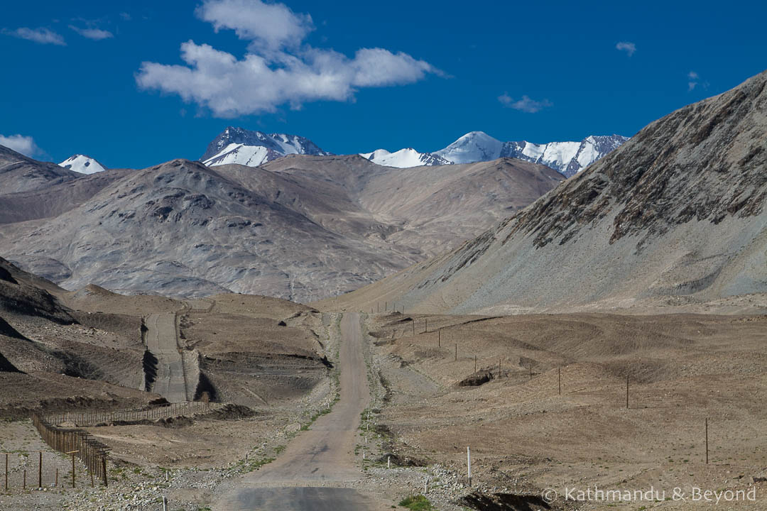
Climbing higher on the high-altitude highway, today we crossed the Ak-Baital (White Horse) Pass, at 4,655 metres, before reaching Murgab.
 Ak-Baital (White Horse) Pass, Tajikistan
 Karakul to Murgab on the Pamir Highway, Tajikistan
Wild-west in feel, Murgab was our base for exploring the pretty Pshart Valley.
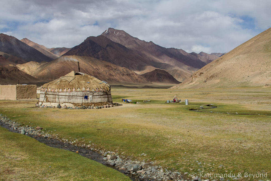 Nomads in the Pshart Valley near Murgab, Tajikistan
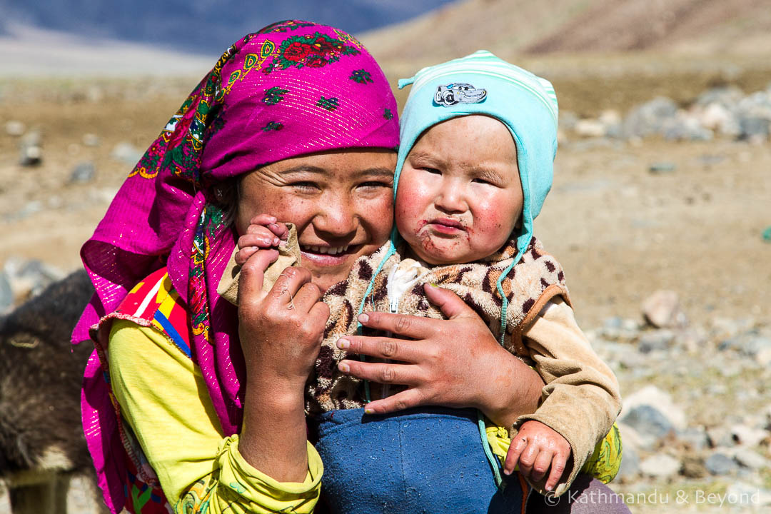 Nomads in the Pshart Valley near Murgab, Tajikistan
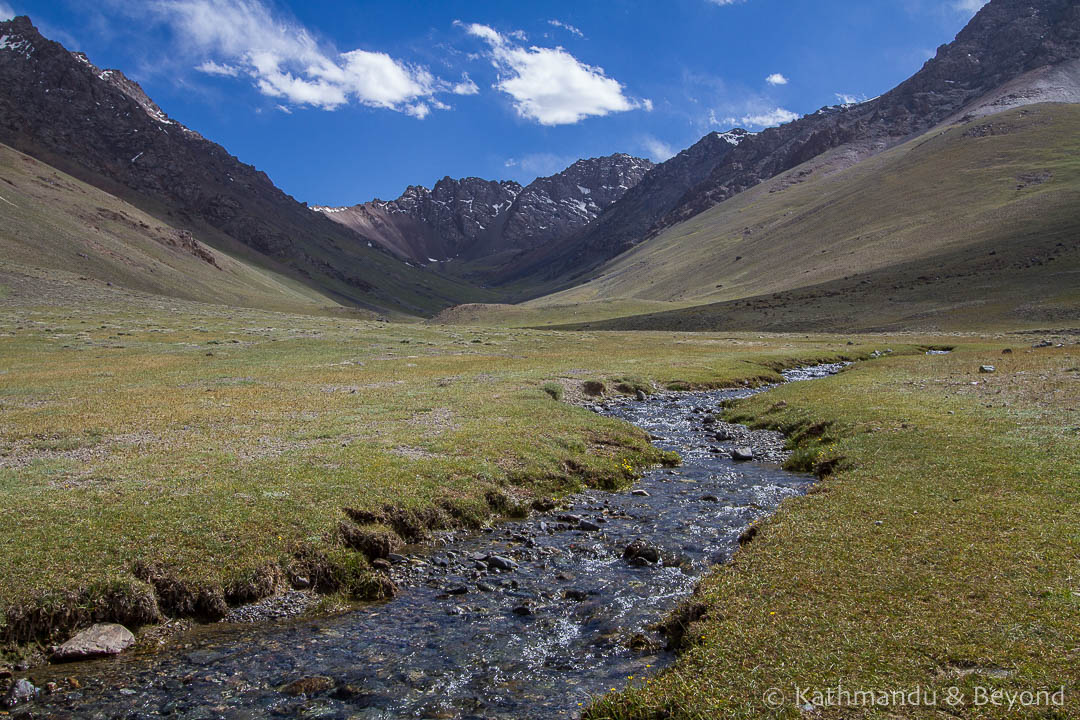 The Pshart Valley near Murgab, Tajikistan
Day 5 – Murgab to the Madiyan Valley and on to Bulunkul and Lake Yashil-Kul
This morning, before continuing along the Pamir Highway, we ventured into the Madiyan Valley.
 Madiyan Valley, Tajikistan
 Madiyan Valley, Tajikistan
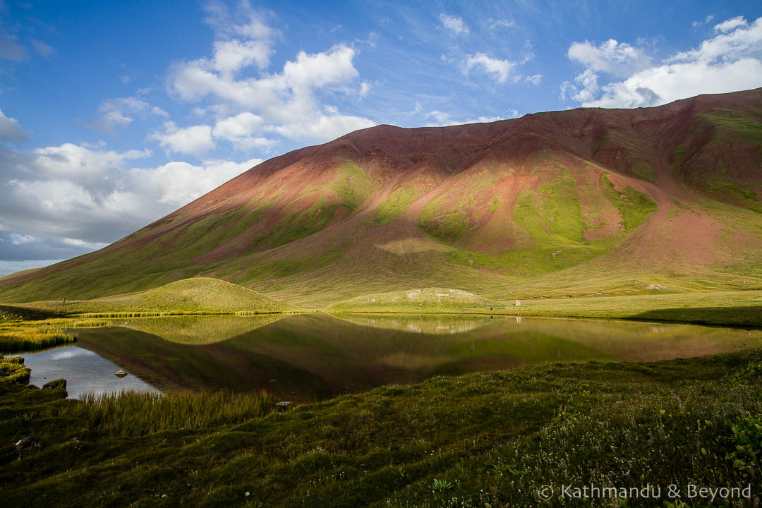
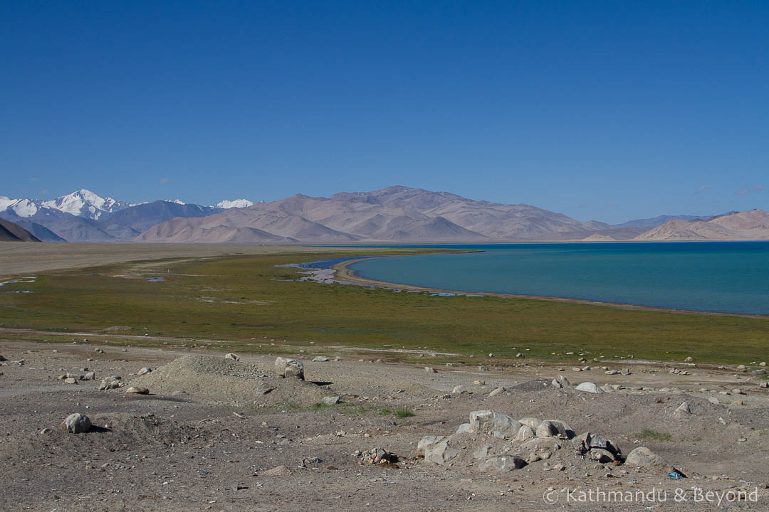
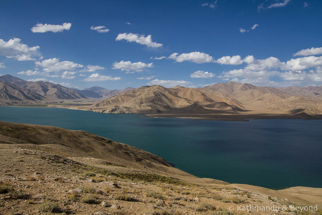
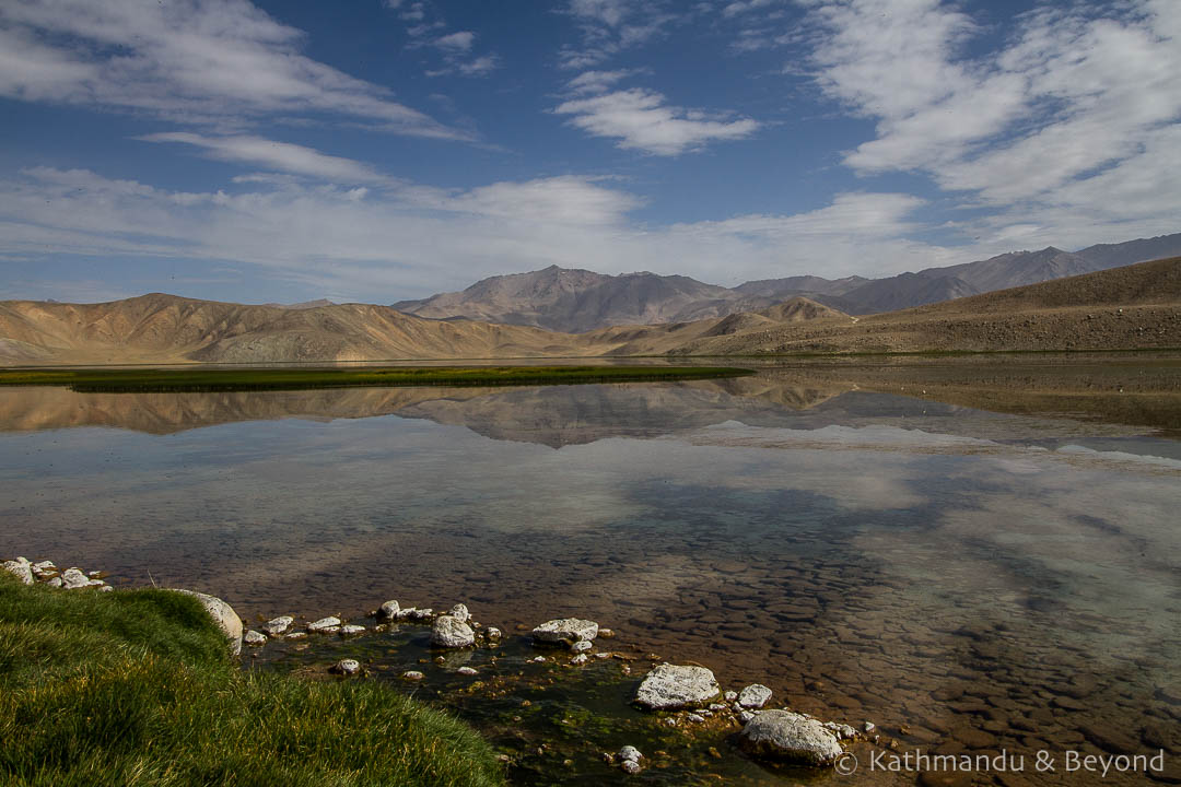
We detoured from the highway to Bulunkul, from where we drove up to picturesque Lake Yashil-Kul before spending the night in the village. Hovering at around 3,700 metres the village is home to Lake Bulun-Kul, arguably more photogenic than Yashil-Kul – if you can stand the swarms of mosquitos!
 Bulunkul Village on the Pamir Highway, Tajikistan
 Bulunkul Village on the Pamir Highway, Tajikistan
 Yashil-Kul Lake near Bulunkul, Tajikistan
 Bulun-Kul Lake, Tajikistan
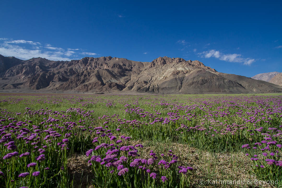
Day 6 – Bulunkul to Langar and Hisor
 Scenery near Bulunkul, Tajikistan
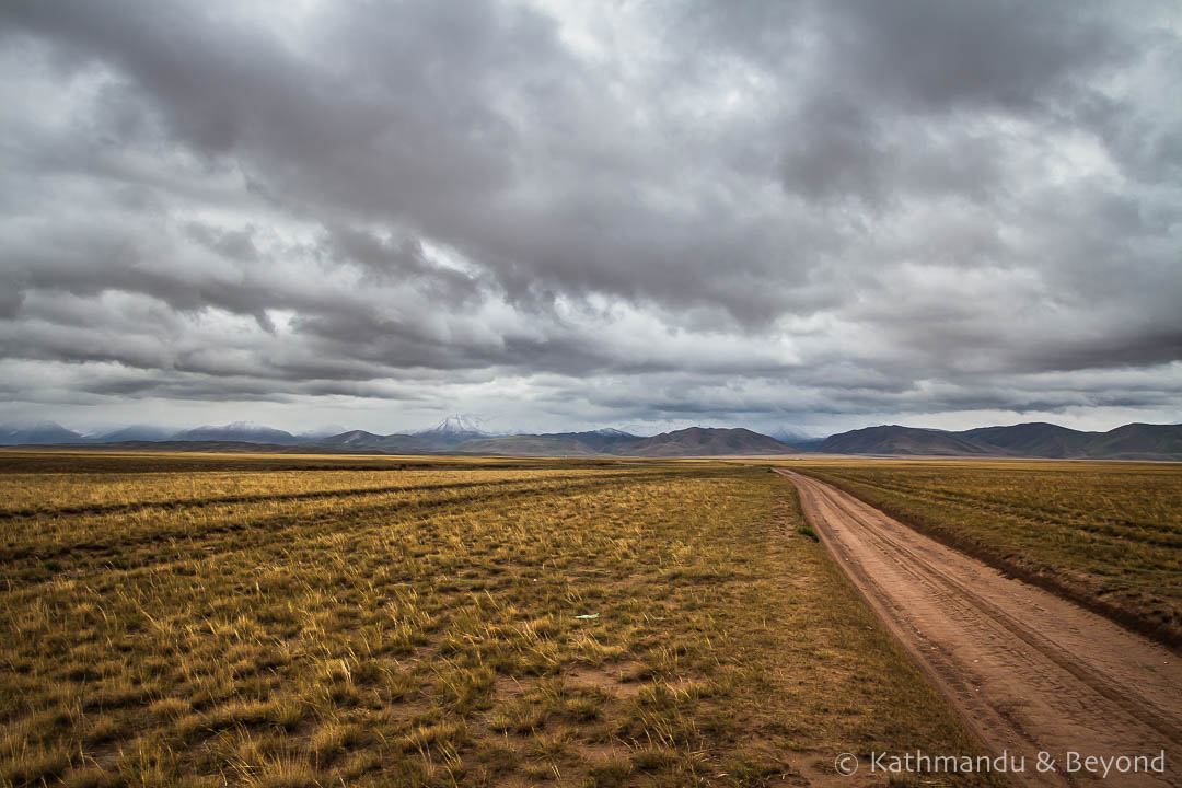
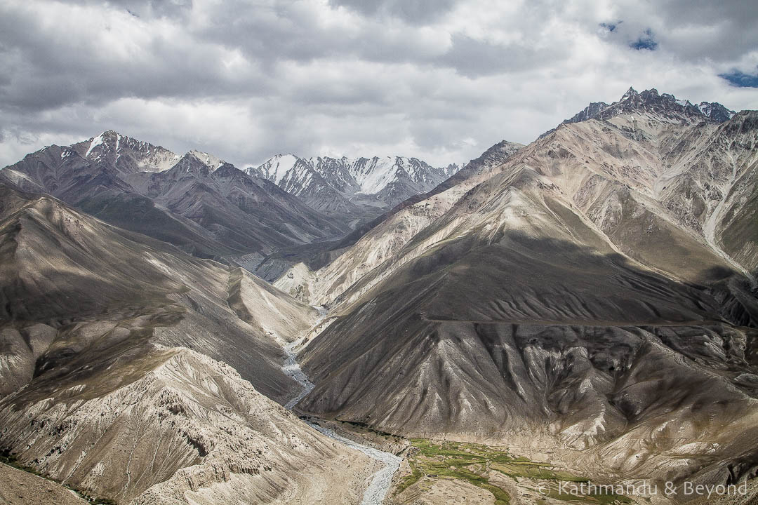
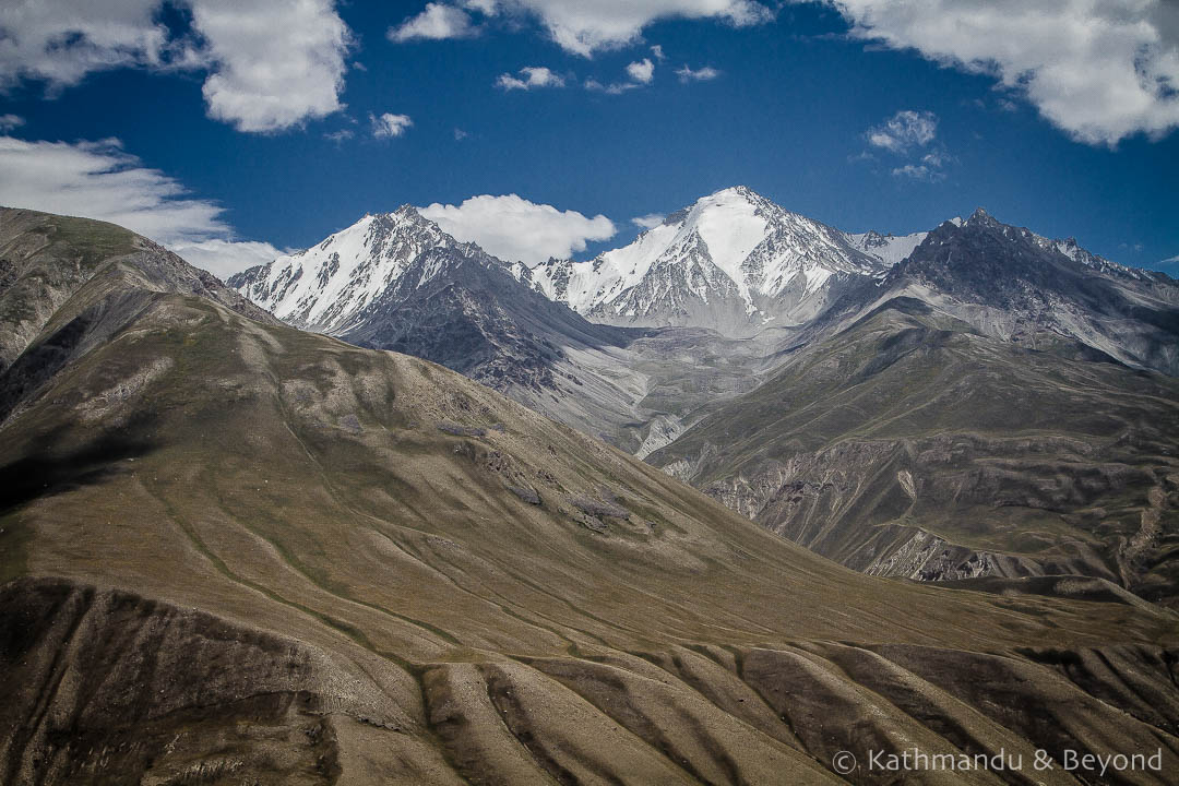
Today, we rejoined the Pamir Highway briefly, before turning off and heading towards the fabled Wakhan Valley, crossing the Khargush Pass. The views here, at 4,344 metres, provide a tantalising first glimpse of Afghanistan and the snow-capped peaks of the Hindu Kush beyond.
 Bulunkul to Khargush in the Wakhan Valley, Tajikistan
 Khargush Pass, Wakhan Valley, Tajikistan
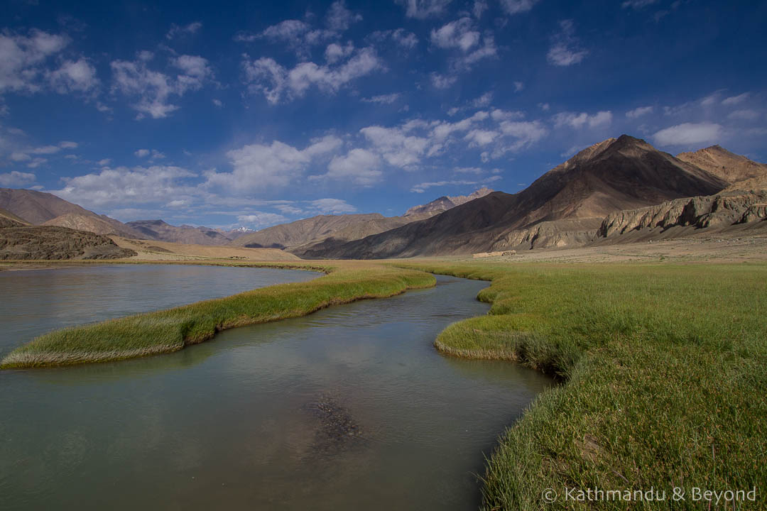
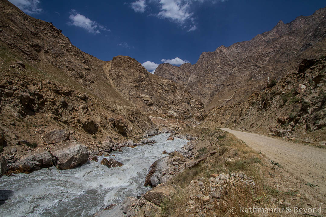
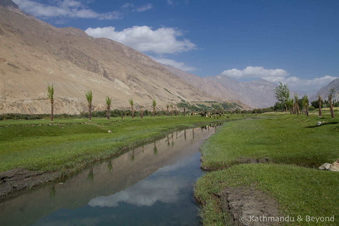
Soon after this point, we were hugging the Afghan border and the excitement rose. If we’d been bowled over by the views up until this point, well…
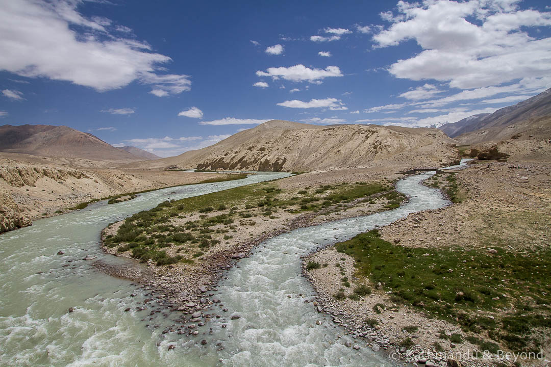
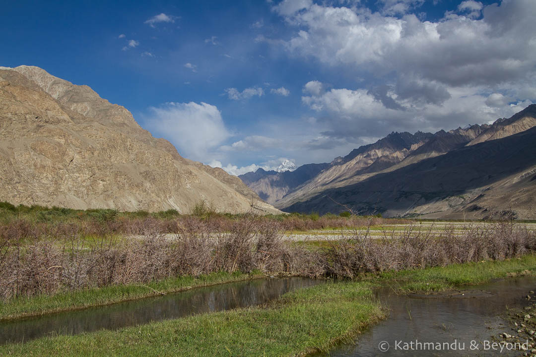
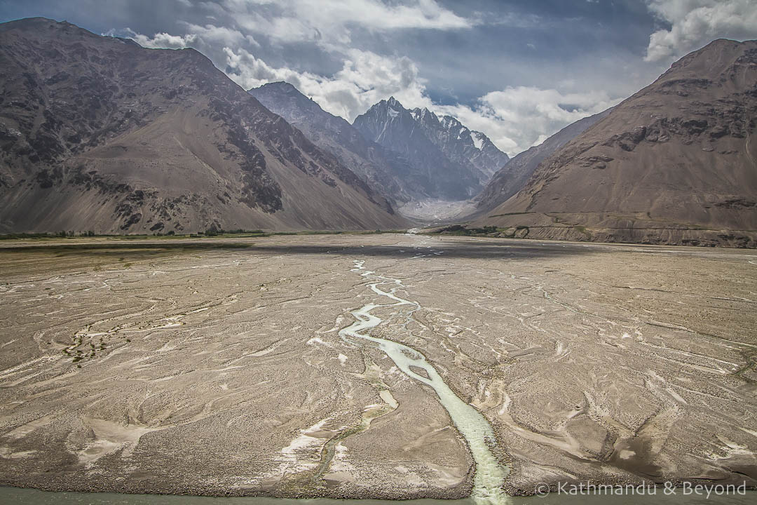
The river acts as a natural border between Tajikistan and Afghanistan, separating the stark, jagged landscapes of both countries with a raging torrent. This was the scenery we had come to Tajikistan to see and it didn’t disappoint.
 Khargush to Langar in the Wakhan Valley, Tajikistan
 Khargush to Langar, Tajikistan
 Khargush to Langar, Tajikistan
We realised that we weren’t going to reach our destination before dark if we didn’t resist the urge to ask our driver to stop every few minutes for photos! We would follow the river for a few days yet, so there would be many more opportunities …
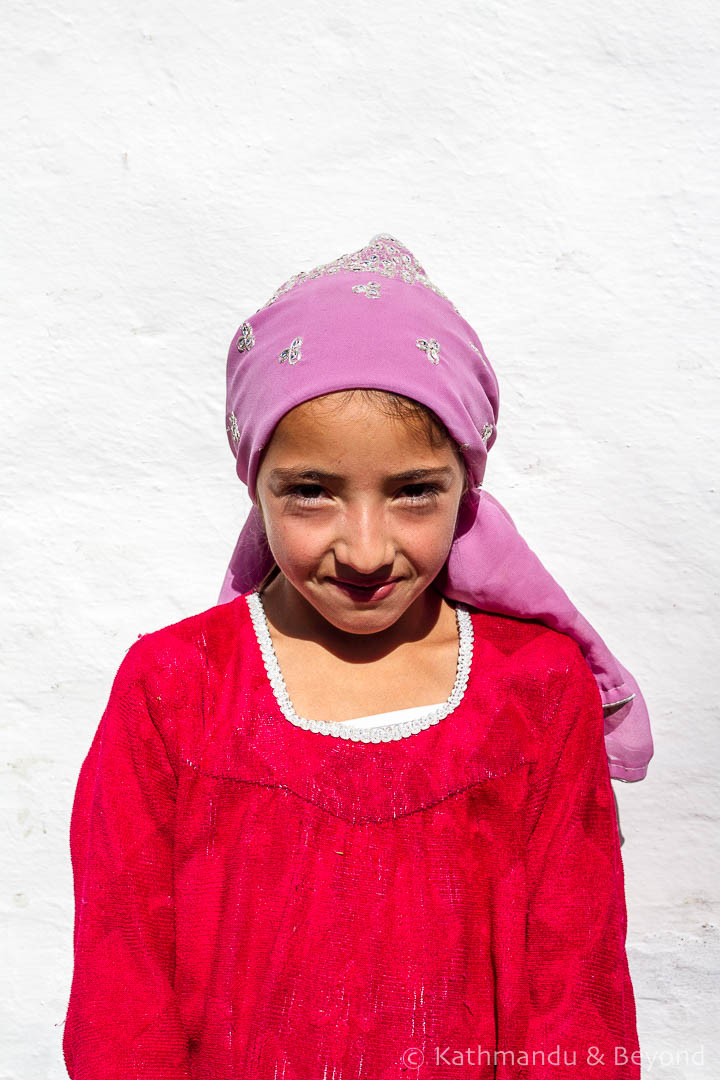
We were happy we did reach Langar in good time, as our overnight here provided the perfect opportunity to stretch our legs and explore this Pamiri village, along with neighbouring Hisor.
 Langar, Tajikistan
Langar, Tajikistan
 Hisor, Tajikistan
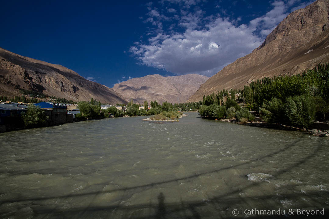
Day 7 – Hisor to Ishakashim
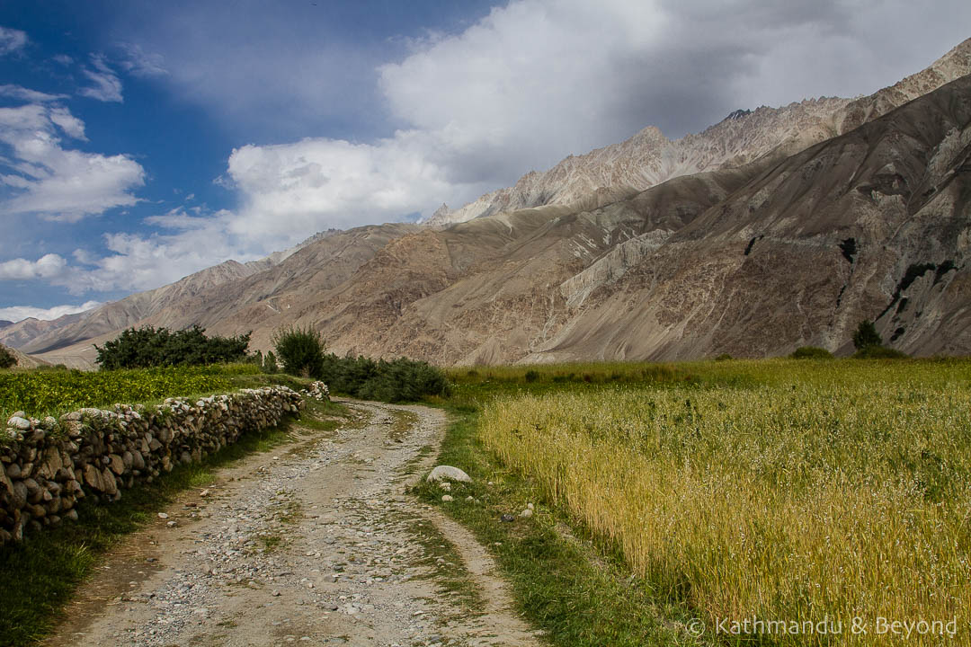
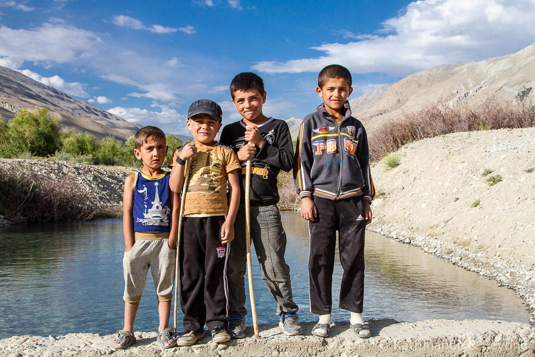
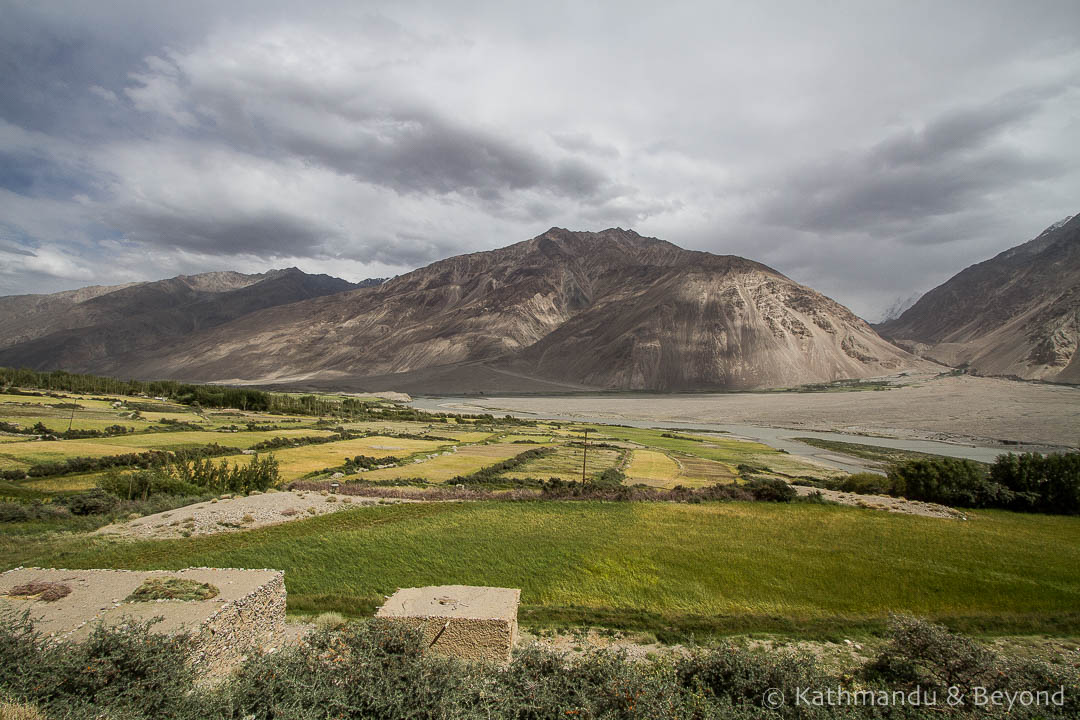
The drive today was along a beautiful stretch of the valley, dotted with small villages and farmland but still with Afghanistan as a constant backdrop. To add to the landscape, we visited fortresses at Yamchun and Namadgut.
 Hisor, Tajikistan
 En route from Langar to Yamchun, Tajikistan
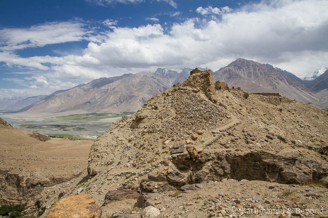 Yamchun Fortress in the Wakhan Valley, Tajikistan
 Yamchun Fortress in the Wakhan Valley, Tajikistan
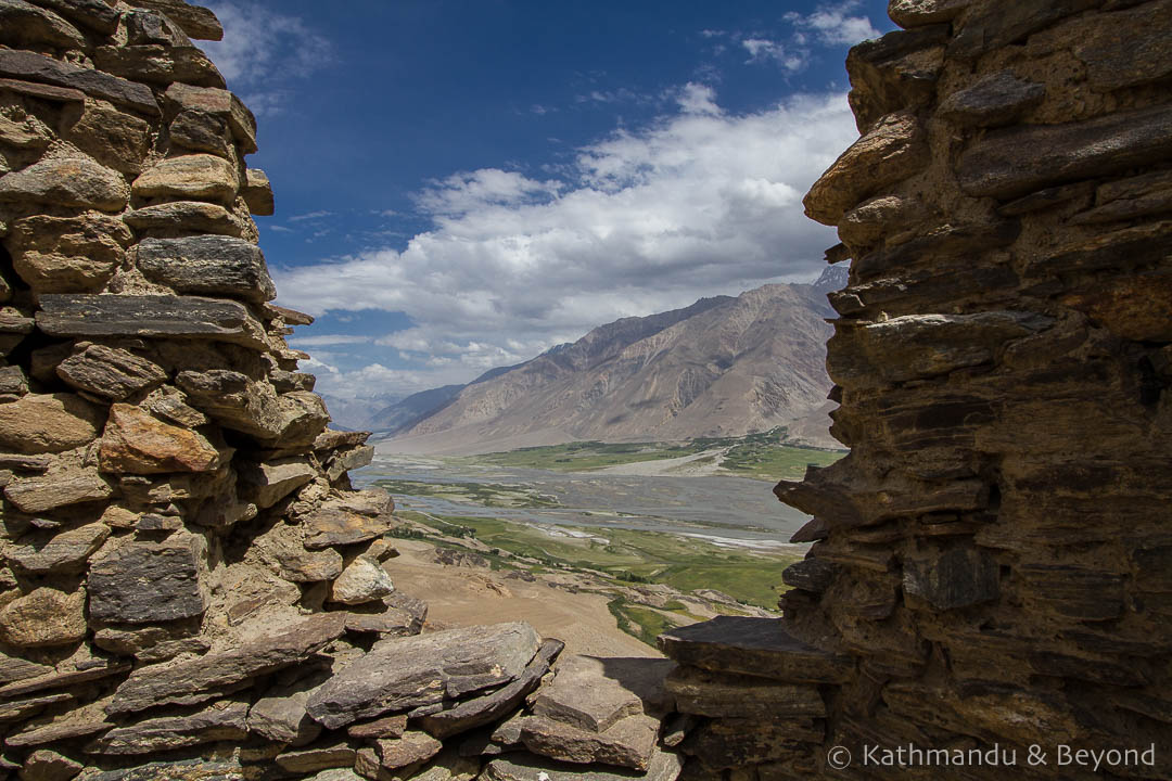 Yamchun Fortress in the Wakhan Valley, Tajikistan
Day 8 – Ishakashim to Khorog
For some reason, we imagined that once we left the Wakhan Valley, that would simply be the end of the road as far as superlatives went. We may have become blasé about our views, but they were no less impressive as we reached the end of our epic journey along the Pamir Highway and through the Wakhan Valley.
 Ishkashim to Khorog, Tajikistan
 Ishkashim to Khorog, Tajikistan
 Gunt River (Khorog), Tajikistan
IF YOU ENJOYED OUR PHOTOS OF THE PAMIR HIGHWAY, PLEASE SHARE AND PIN THIS POST…
Incredible, just incredible. It must be a trekker’s delight to wander through these hills and mountains.
Thank you, thank you! 😉
Spectacular photos. I certainly hope I retrace your steps next summer. By the way, why do you suppose Peak Lenin is still named Peak Lenin? Why hasn’t it been renamed for some Kyrgyz or Tajik hero?
Thank you. I believe Lenin Peak has been renamed but I think it’s been given several names and the Kyrgyz or Tajiks can’t agree on what it should be called, Lenin has stuck!
Hi Kirsty,
Breath-taking photos! Brilliant, brilliant, brilliant. My fave is the doggie in front of the Lenin Base Camp. The mountain scenery is dynamic, dramatic and so freaking eye-popping I found myself drooling looking at it LOL. Amazingly pristine place. How cool to see a pollution-free spot. A REALLY pollution-free place. Thanks for sharing!
Ryan
Thank you. Glad you enjoyed the post – Our photos probably only do the scenery a tiny bit of justice but hopefully get across the awesomeness of the place! 🙂
Guys, you really did this region justice. Those photos are beyond epic!
We’re going to look into this region for an adventure now!
Thank you! To be honest, it’d be quite hard not to do it justice – it’s such a photogenic region. And if you’re looking for adventure, Central Asia is definitely a great choice! 🙂
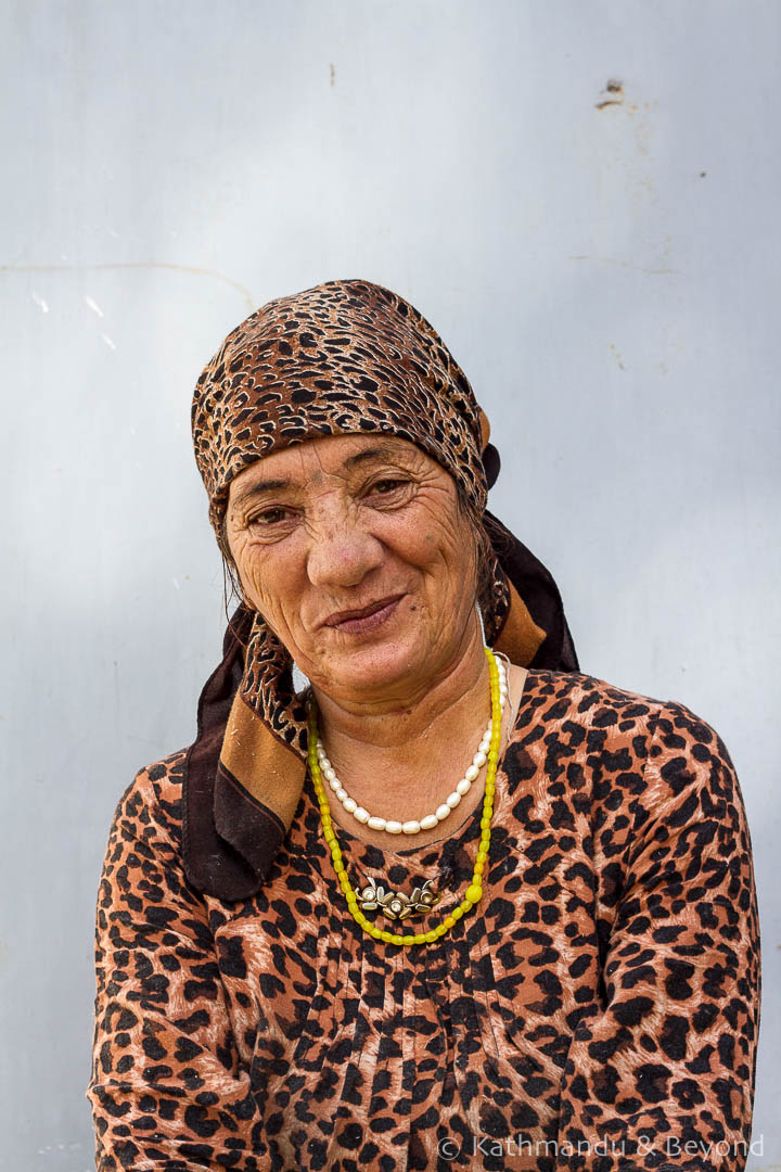
This is an incredible photo essay, Kirsty. What was your impression of the people living traditionally?